~Select arrow for location key~
The Livingston Range begins at Stanton Mountain above Lake McDonald and heads north to join the Continental Divide at Trapper Peak, and then continues north to the Canadian Border. It contains many rivers creeks streams and lakes. In the image above, Kintla Lake is in the foreground under Starvation Ridge, while in the distance across the Canadian border with Montana, Miskwasini Peak has avalanche trails reaching down to the valley below. This is the Akaminia-Kishinena Provincial Park, a stunningly beautiful wilderness. Kintla Lake is the farthest north lake located in the North Fork Valley.
The image below is of Bowman Lake ringed by Numa Ridge and the towering Numa Peak on the left, Thunderbird Mountain above the end of the lake with Cerulean Ridge and Rainbow Peak on the right.


~Select arrow for location key~
In the image below, Bowman Lake is a still, serene place. Deeply remote, it is a wonderful place to find solitude and silence. This image was lensed on a summer evening as the clouds rolled in across Thunderbird Mountain in the distance over the end of the lake.
~Select arrow for location key~
Bowman Lake on the left and Quartz Lake peeking around the bend below Quartz Ridge are separated on the Livingston Range by Cerulean Ridge, Square Mountain, and Rainbow Peak. Lower Quartz Lake is hidden behind Quartz Ridge in the foreground on the right. To the right of Quartz Lake are Vulture Peak and Logging Mountain.
The image below is of all 3 parts of Quartz Lake viewed from above Nasukin Mountain. In the foreground is Quartz Lake, as it bends in the distance it is separated by a small land bridge from the smaller part, while further down the same valley lies Lower Quartz Lake, connected by Quartz Creek.


~Select arrow for location key~
In the image above, One long lone avalanche debris trail has made it down to the frozen surface of Quartz Lake from high above on the mountainside of Square Peak. Across the valley over Quartz Ridge, the Flathead River flows southward the distance along the base of the Whitefish Range.


~Select arrow for location key~
Above; Clouds play lovely tricks with lighting in this view of Logging Lake, naturally vignetted by the passing thunderstorm clouds. Along the rugged mountainous Livingston Range, to the left above Loggin Lake are Logging Mountain and Vulture Peak. Above the end of the lake are Mount Geduhn and Anaconda Peak. To the right along the skyline are; Wolfgun Mountain, Dutch Ridge, Longfellow Peak, Paul Bunyan’s Cabin, and Rogers Peak.


~Select arrow for location key~
Logging Lake is behind the precipitous ridgeline of Mount Geduhn and the Trapper Peak in this image above while in the image below Logging Lake is viewed from above the sharp ridgeline of Mount Geduhn in the foreground. Avalanche debris covers the sides of Logging Mountain on the right side of the image.


~Select arrow for location key~
The following image shows the small and exceptionally beautiful Trout Lake. Nestled between Heavens Peak, MacPartland Mountain, Mount Vaught, and Stanton Mountain on the left to the south, and the long ridges of Rogers Peak on the right. This image was lensed directly above the tiny Camas Lake, up high in the Camas Creek valley below Paul Bunyan’s Cabin.


~Select arrow for location key~
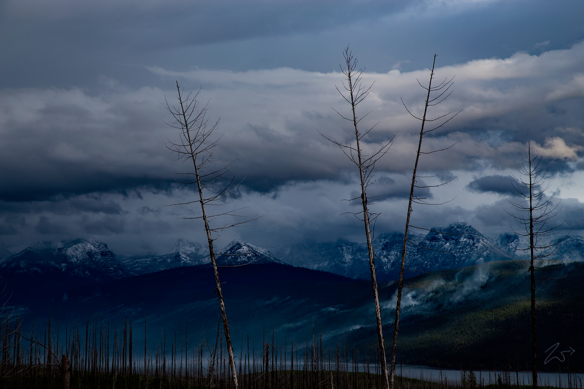
In the image above, Lake McDonald is out of sight just over the ridges of Heavens Peak on the left, and in the distance are the snow-covered Apgar Mountains and the Whitefish Range. Along the ridgeline in the immediate foreground on the right side of the image are the blueish-hued debris trails left by avalanche activity.
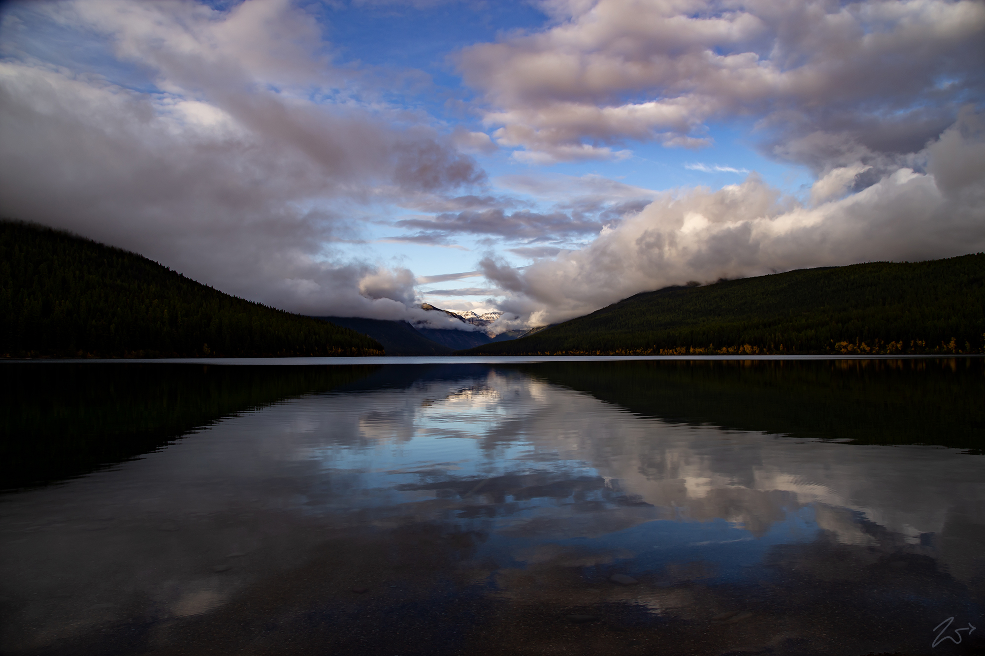
Below; Looking west over the steep rocky mountainsides of Mount Cannon on the left and Heavens Peak on the right, Lake McDonald is the largest lake along the Livingston Range and the farthest south of all the lakes. The snow-covered mountains in the distance beyond the lake on the right are the Apgar Mountains. On the south side of the lake to the left in this image lay the slopes of Synder Ridge.


~Select arrow for location key~
In the following dramatic image, looking to the south across Lake McDonald Ghost Clouds dance along the slopes of Snyder Ridge, while dusk clouds close in on the mountains of the Lewis Range; Mount Brown, Edwards Mountain, and Walton Mountain.