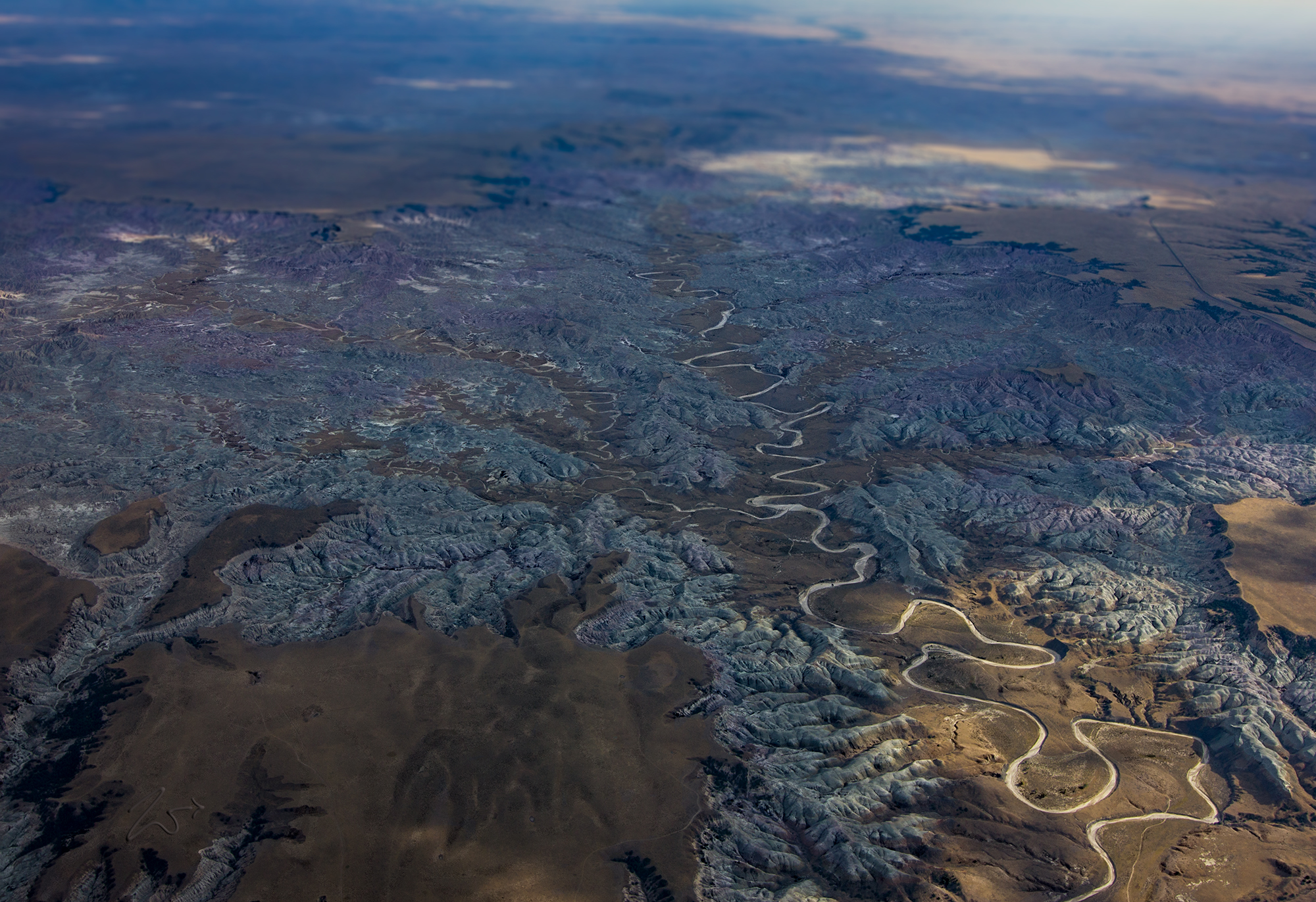
This unusual formation is in the Badlands of South Dakota. Those white lines are thousands of rivulets, washes, creeks, and streams. The larger creek on the right is called Squaw Humper Creek, and to the left on top, joining the creek is Little Squaw Humper Creek.
Badlands National Park (Lakota: Makȟóšiča) is a national park in southwestern South Dakota that protects 242,756 acres (379.306 sq mi; 98,240 ha) of sharply eroded buttes, pinnacles, and spires blended with the largest undisturbed mixed grass prairie in the United States. For 11,000 years, First Nations Native Americans have used this area for their hunting grounds. Long before the Lakota were the little-studied paleo-Indians, followed by the Arikara people. Their descendants live today in North Dakota as a part of the Three Affiliated Tribes.
Archaeological records combined with oral traditions indicate these tribes camped down in secluded valleys where fresh water and game were available all year round. One can still find, eroding out of the stream banks today, the rocks and burnt charcoal remains of ancient campfires, as well as arrowheads and cutting tools that were used to butcher bison, rabbits, and other hunted game.
From the top of the Badlands, they could scout the area for their enemies and locate wandering animal herds. If hunting was good, they would remain into the winter months before retracing their way back to villages along the Missouri River. By one hundred and fifty years ago, the Great Sioux Nation, consisting of seven bands including the Oglala Lakota, had displaced most of the other tribes from the northern prairie.
