

~Select arrow for location key~
The Garden Wall is an almost 15-mile long steep, precipitous alpine mountainside located within Glacier National Park. It is the long thin arête or rock backbone (spine) that partitions the Many Glacier region of the park from the western side with McDonald Creek which empties far downstream into the valley and Lake McDonald.
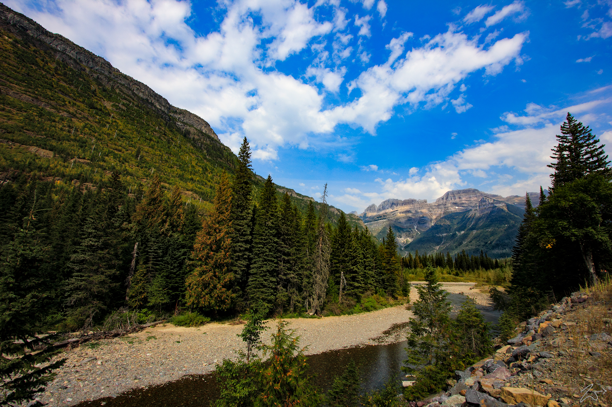
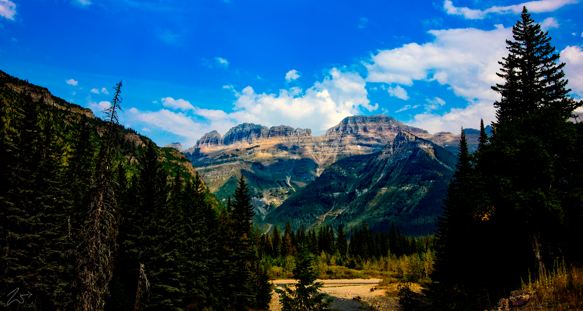
An iconic and globally beloved part of the park, it is covered in a multitude of different species of flowering plants and shrubs in bloom during the late spring and summer months. In the image above, part of the Garden Wall is visible above the end of the valley in the distance. This view above is alongside McDonald Creek at the base of the Glacier Wall formation on the left. In the image below, take a few miles further up the canyon, the Garden Wall towers above the triangular peaked Haystack Butte in the upper right center of the image.
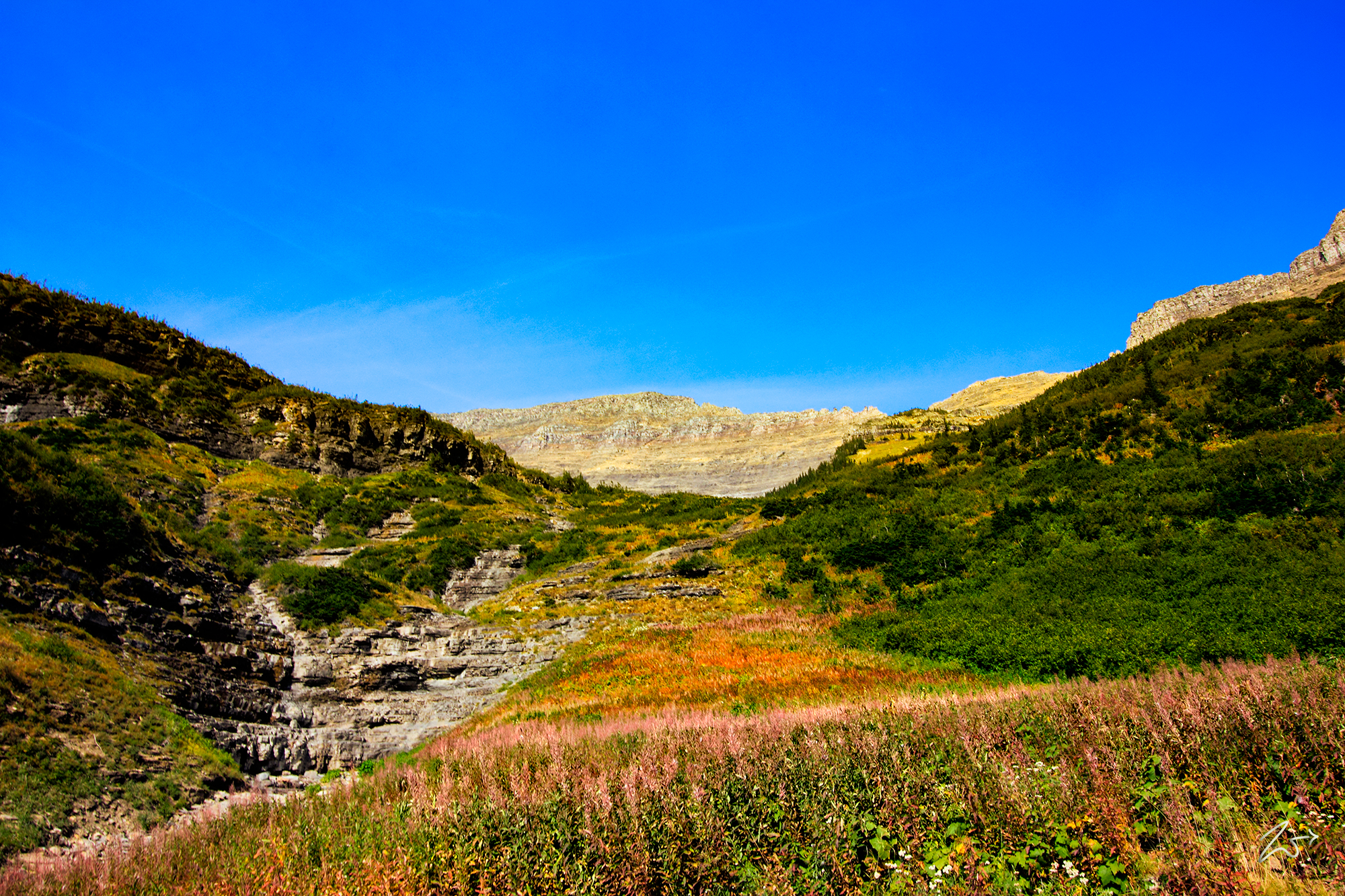
The image above of the lofty steep mountainous slopes below the Garden Wall shows the large variety of flora still in bloom in the early fall months. High above, the craggy rocks of the ridgeline run between the Garden Wall, from Mount Gould to Swiftcurrent Mountain. A small waterfall on Alder Creek is on the left side of this image, this creek flows all the way down to McDonald Creek below.


~Select arrow for location key~
In this dramatic image above, flying high above Gunsight Mountain, Reynolds Mountain is in the center of the image with Hidden Lake below and to the left. Hidden Lake is ringed by Clement Mountain, Mount Cannon, and Bearhat Mountain. to the right across the valley from Mount Reynolds lies the Garden Wall, stretching north towards the top of this image. This is in the late autumn near wintertime when all the snow has melted from the rocky precipices.
The image below is the iconic setting available from Hidden Lake Pass near the Hanging Gardens above Logans Pass. On the right is Polock Mountain then the ridgeline running to Bishops Cap, jutting skyward in the center. In the distance along the ridge are Mount Gould and the rocky cliffs of Swiftcurrent Mountain.


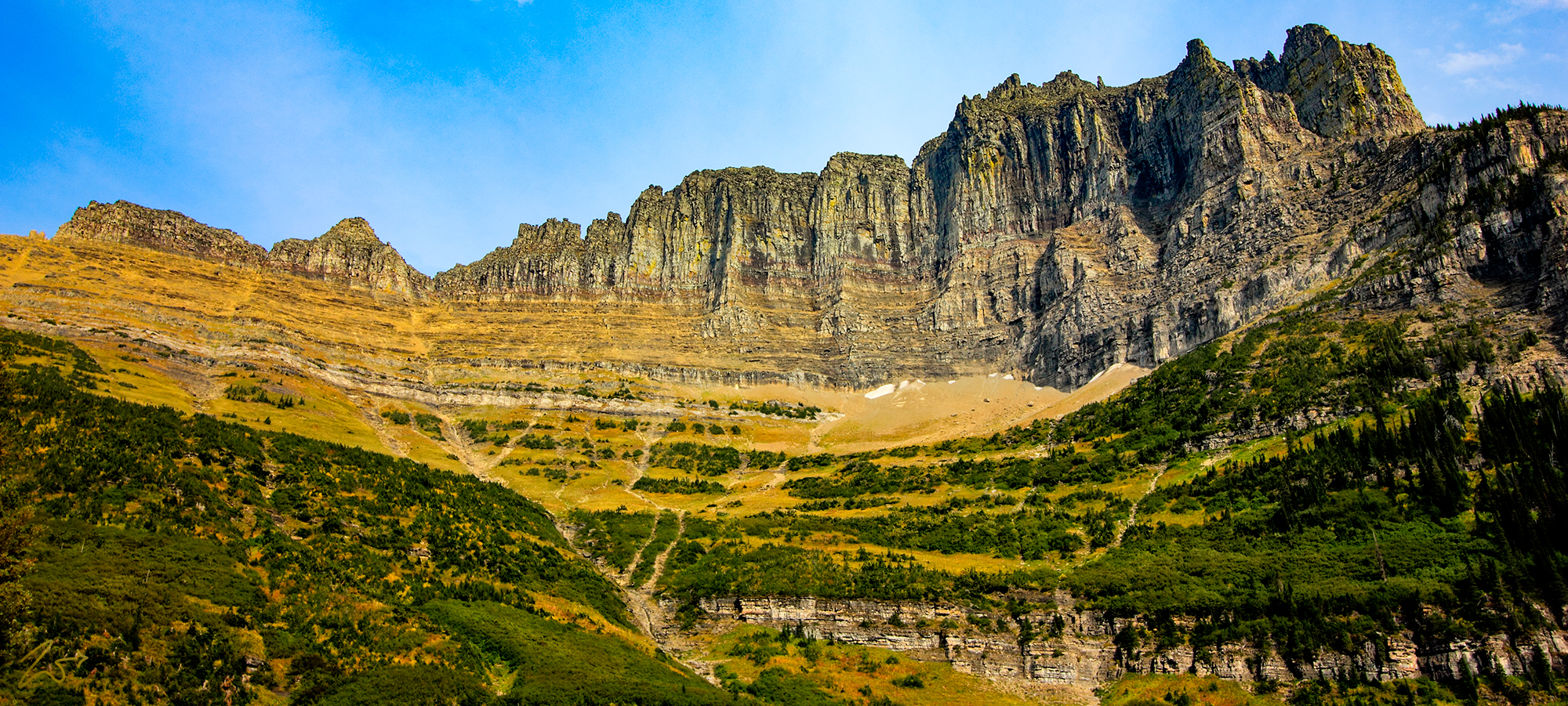
~Select arrow for location key~
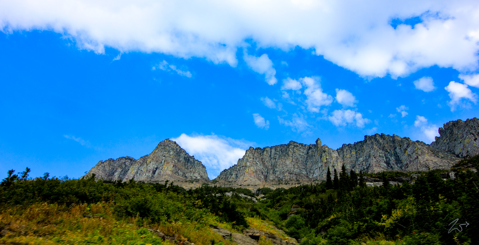
The image above shows the near-vertical slopes of the Garden Wall as seen from far below along the base of McDonald Creek. Mount Gould is on the left and Bishops Cap is the tower sticking up from the middle of the ridgeline. Below; this area of the Garden Wall is known as the Weeping Wall, for its many streams and rivulets, This geological formation is found along Going-to-the-Sun Road and contains waterfalls that seep out from the side of the Garden Wall, and is fed by runoff from snowmelt. During certain times of the Spring season, snowmelt water cascades down the steep mountainsides so fast it sprays out over the road, providing a really interesting effect.


~Select arrow for location key~
The image above is a unique view of the back or eastern side of the Garden Wall with Mount Gould on the right and then a very narrow, dizzying precipitous ridgeline of jagged rock which meets Bishop Cap and then continues on to Polock Mountain. In the distance behind Bishops Cap is Logans Pass and the Hanging Garden.
