MIXED MEDIA EDITION #3 of 10
BACKSTORY
This Ambient Exploration was experienced while flying in a large arching circle around the Flathead National Forest at the north end of the John F. Stevens Canyon in the Theodore Roosevelt Pass. Bordering the western side of Glacier National Park, in the Rocky Mountains of Northwestern Montana, these mountains and this beautiful valley are part of the Lewis Range, located in the Rocky Mountains of northwestern Montana, and the extreme southern end of Alberta, Canada. The range extends across the Waterton Lakes National Park in Alberta, Canada down into Glacier National Park, and the Bob Marshall Wilderness Complex in Montana.
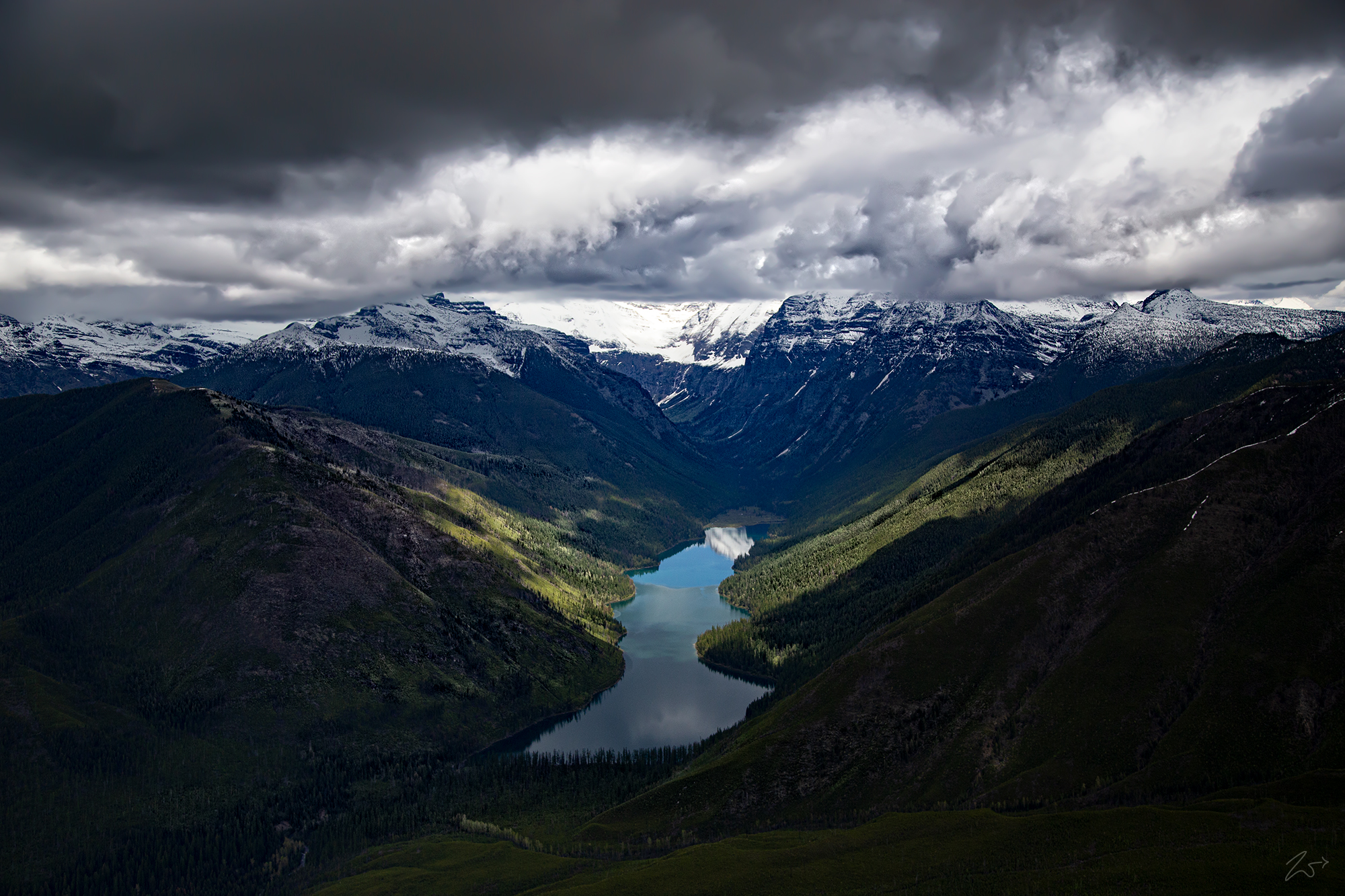
While exploring this beautiful wilderness I passed over Harrison Creek, at the entrance to the long valley containing the remote Harrison Lake. This is one of the most difficult lakes to reach in Glacier National Park, thus it is rarely visited.
Featuring a composition written by Zedekiah Morse specifically for this film, the music provides a melodious sonic backdrop that accompanies the visuals for a wonderfully immersive experience.
Location Map Set
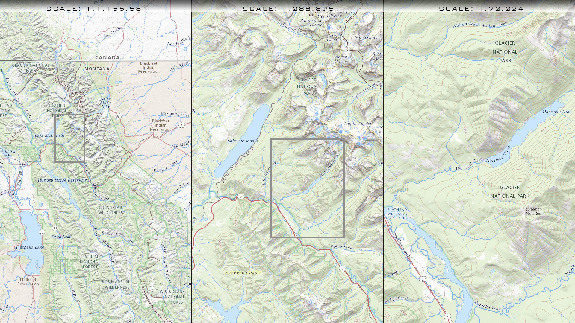
Flight Path
Flying above the northern end of what is called the “Flathead Wild And Scenic River”, between Pyramid Peak on the west side of the river in the Swan Range, and Loneman Mountain on the west side of the river in the Lewis Range, we move in a circular pattern towards the south till we reach Halfmoon lake. We then turn towards Mount Penrose to the west and then back north along the river to complete the circle. Then we repeat the course again turning south.
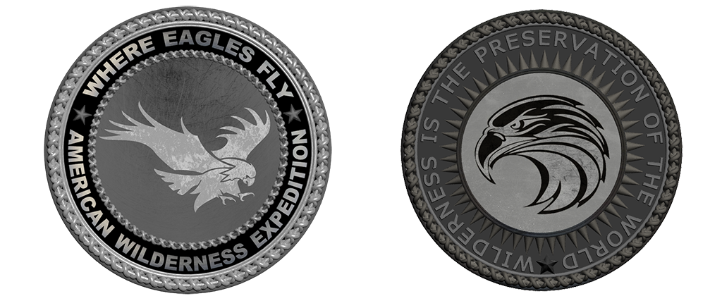
Accompanying Physical Goods
This is a very rare physically minted commemorative coin for “Where Eagles – American Wilderness Expedition”. This metal coin is 2.5″ in diameter and features a custom precision design that is struck using the highest quality metals. It comes with a display case. Shown below is the front side (L) and backside (R).
Angel Wings on Harrison Lake
This image is from a scene that appeared while traversing the northeastern side of the John F. Stevens Canyon in the Theodore Roosevelt Pass. Sunlight streaming straight down from breaks in the occluding cloud layer paints the shape of wings that lay across both sides of Harrison Lake. The shape of the lake combined with the sunlit wings resembles a bird or a Peace Dove with the top end of the lake in the distance up the valley, reflecting the blue sky directly above, yet unseen by us at this altitude as we are the same height as the clouds.
In the distance at the top right end of the valley are Blackfoot Mountain, and Pumpelly Glacier. On the top left end of the valley lies Walton Mountain and Harrison Glacier. Harrison Glacier is the headwaters of Harrison Lake and Harrison Creek..