~Select arrow for location key~
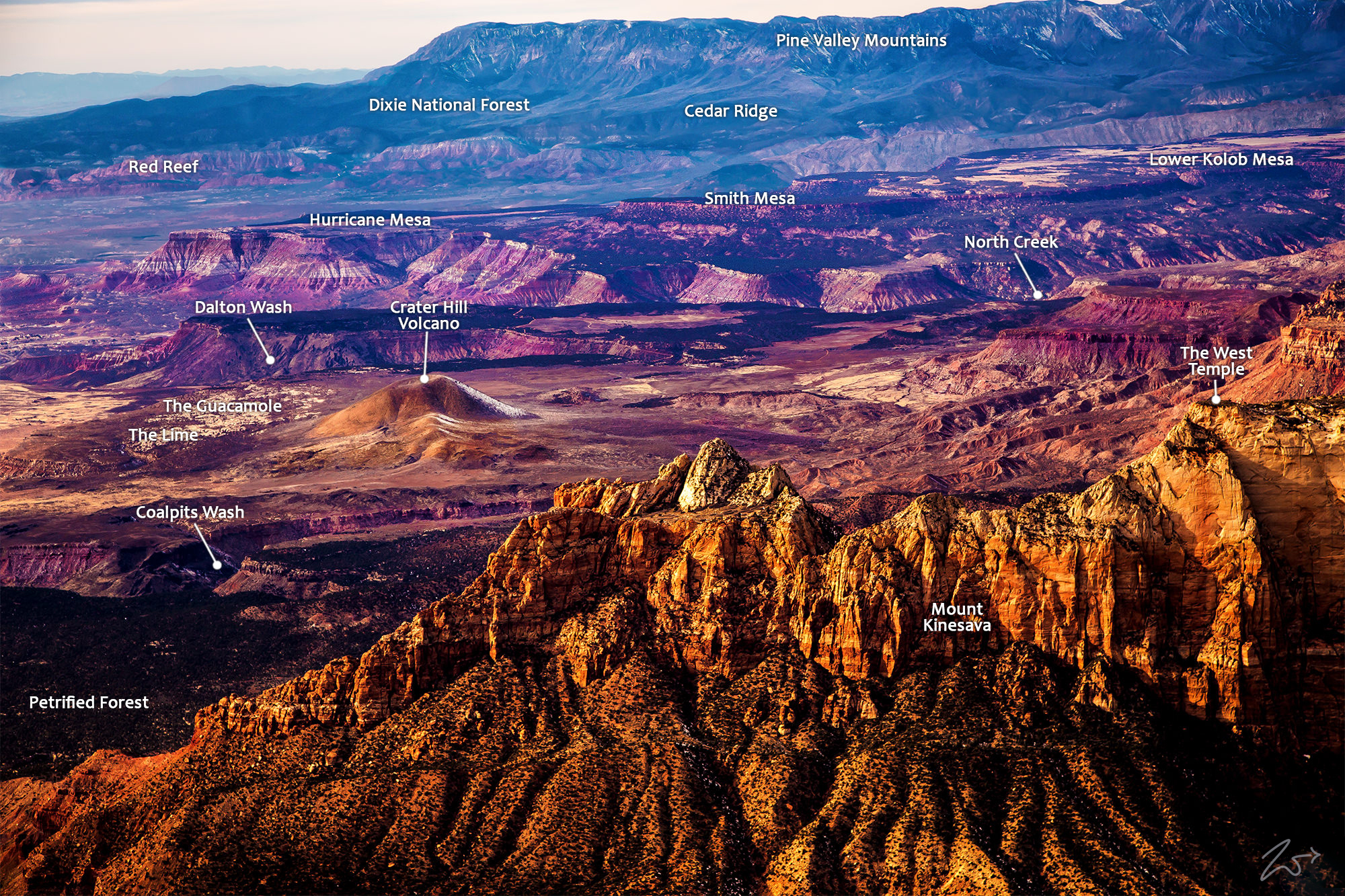
Crater Hill Volcano
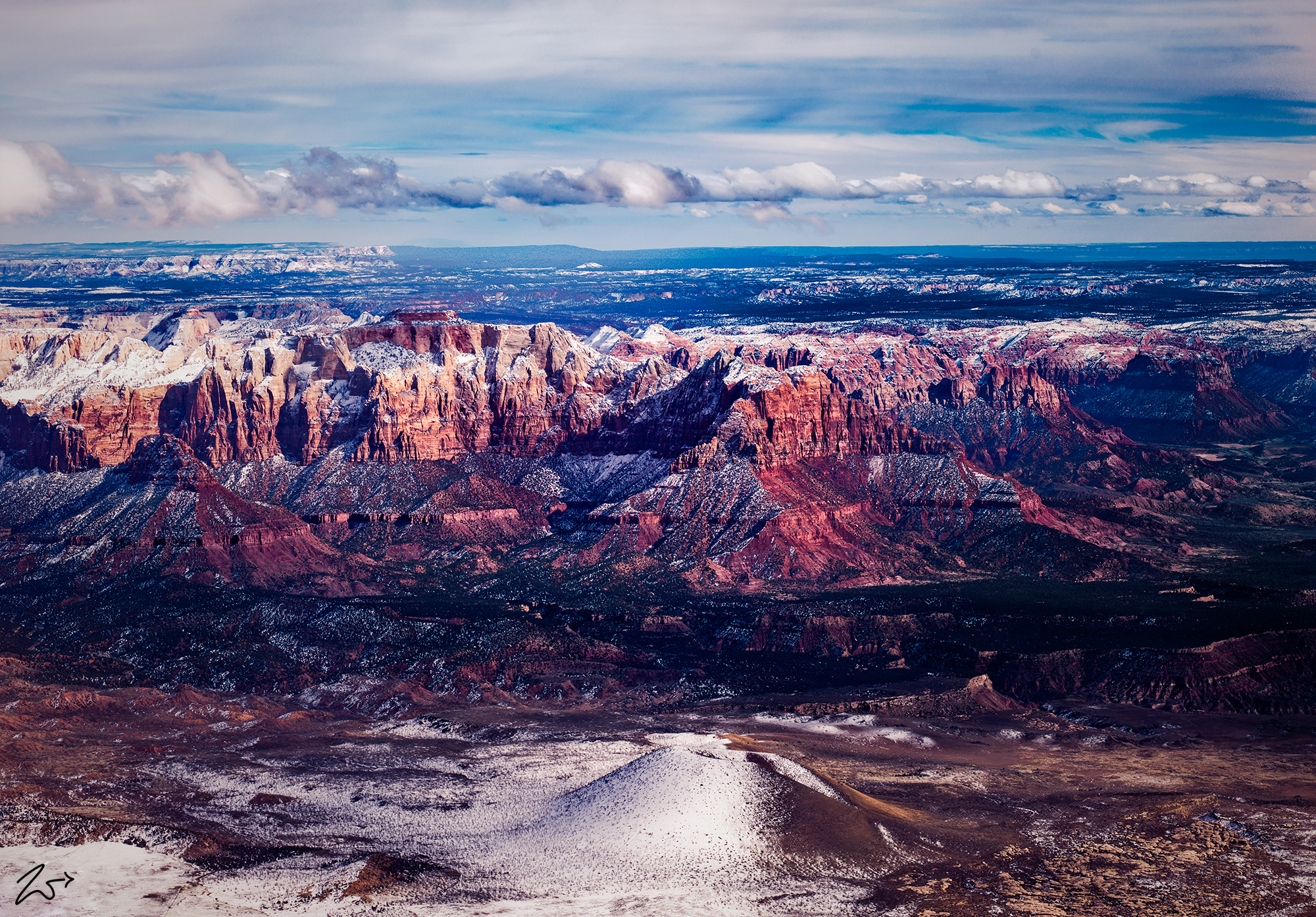
Zion’s proximity to the geological formation known as the Basin and Range Province caused relatively recent volcanism which rings the plateau. This volcanism takes the form of cinder cone volcanoes and basalt flows found throughout the Zion region with the last activity estimated to have occurred possibly only 1,000 years ago, a short time in geologic happenings! This is calculated by the various tribal artifacts found embedded in lava around the park.
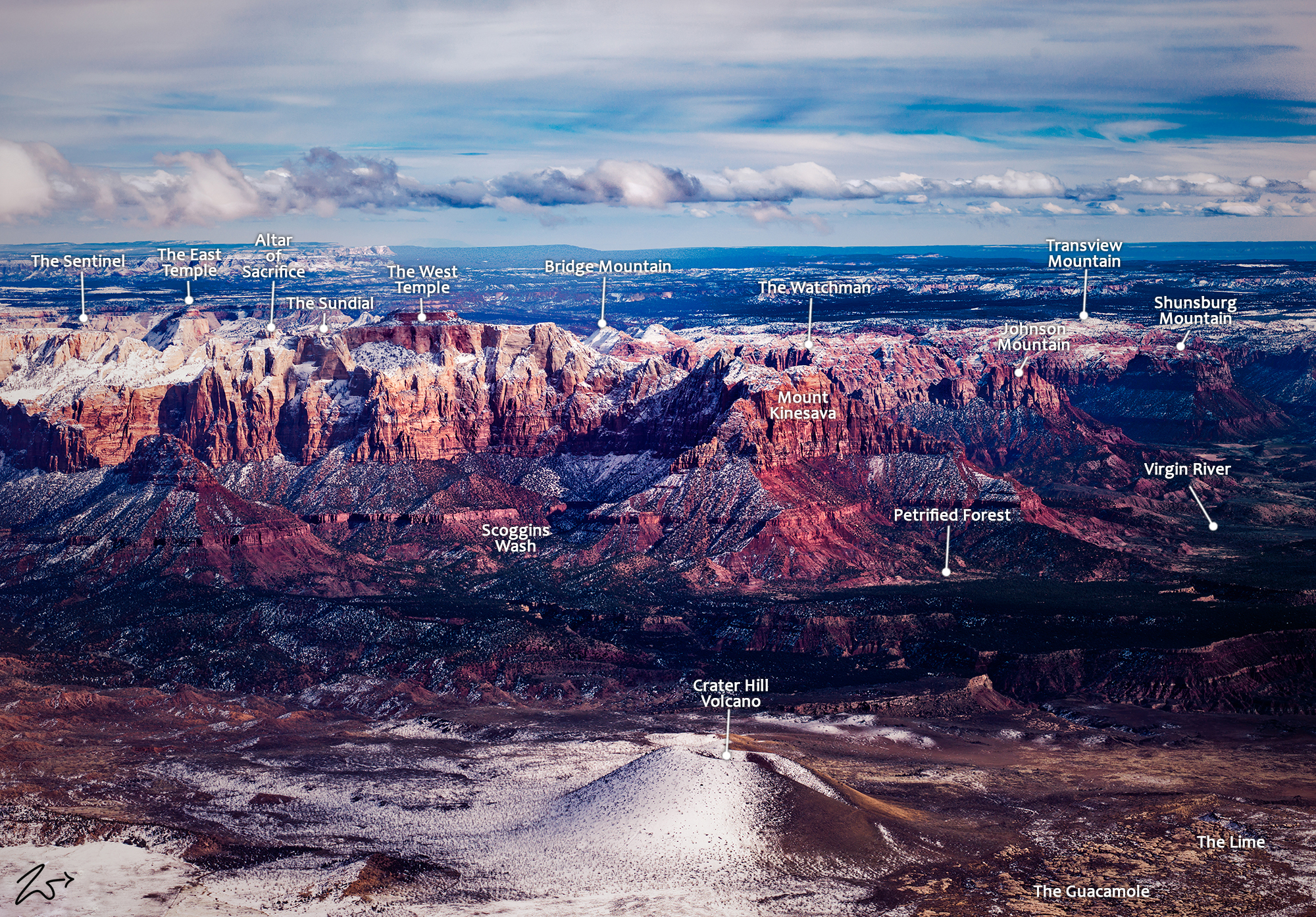
The ancient cinder cone volcano known as Crater Hill sits in the valley beyond Mount Kinesava (in the foreground) in this image I lensed while flying and exploring the wilderness areas around Zion National Park in southern Utah. To gauge the scale of this image size, each of those dark dots on Mount Kinesava is a large tree.
Volcanic vents form with a weakening of the Earth’s crust during uplift events, allowing lava flows and cinder cones to form. Cinder is usually piled several hundred feet high in classic cone shapes and lava flowed outward and down into the valleys.
~Select arrow for location key~
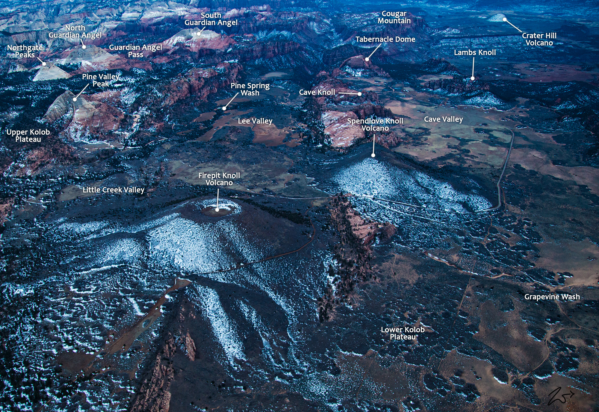
Firepit Knoll Volcano
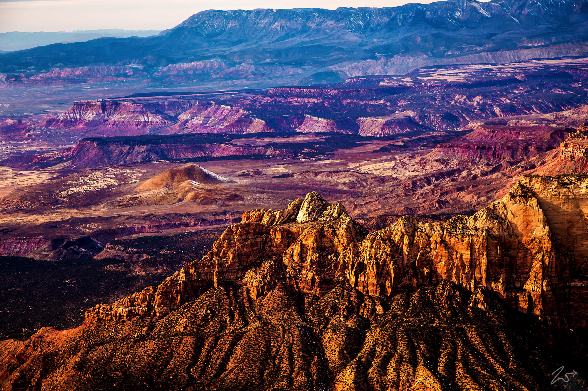
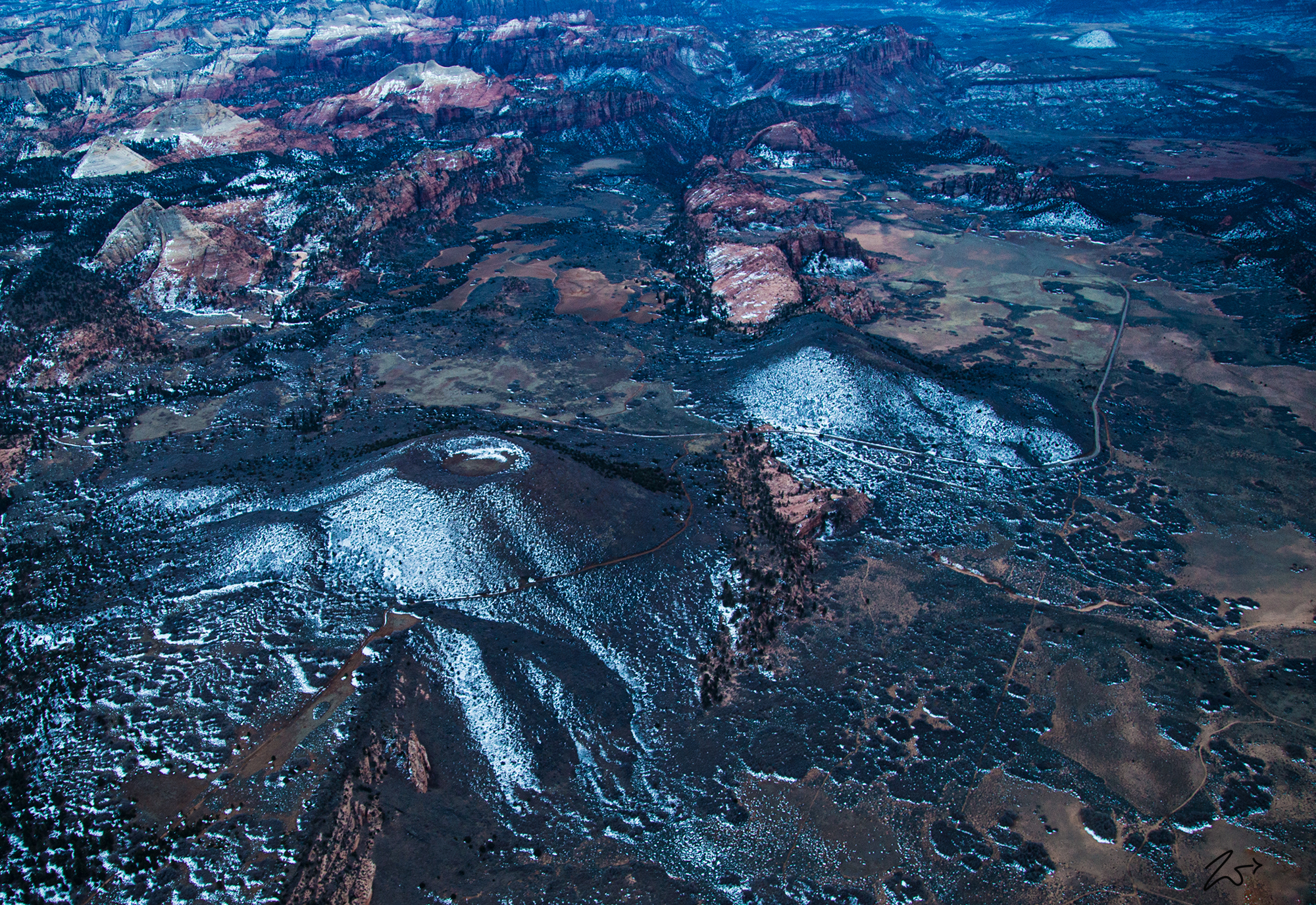
This is an image I took very late in the afternoon of the Firepit and Spendlove Knolls located on the Kolob Terrace. Zion’s proximity to the Basin and Range Province caused relatively recent volcanism which rings the plateau. This volcanism takes the form of cinder cone volcanoes and basalt flows found throughout the Zion region with the last activity estimated to have occurred possibly only 1,000 years ago, which is a very short time in geologic happenings! This is calculated by the artifacts found embedded in lava around the park.
~Select arrow for location key~
The Firepit Knoll on the lower left and the Spendlove Knolls slightly above to the right are two nearly perfectly conical cinder cones located near Kolob Road in the west-central part of the park. These mark two of the volcanic vents associated with the Grapevine Wash basalt flows. Volcanic vents form with a weakening of the Earth’s crust during uplift events, allowing lava flows and cinder cones to form. Cinder is usually piled several hundred feet high in classic cone shapes and lava flowed outward and down into the valleys. On the Kolob Terrace in the park, you can see both Cinder cones and black basalt flows visible just west of Rockville.
Zedekiah: “Though this image is not super clear due to the necessity of cranking up the ISO due to low light, you can still clearly see the defined volcanic vent at the top of the Firepit Knoll. I lensed this image after the first small dusting of snow and while the snow has already begun to evaporate around the volcano it is still present on the north side of each due to the sun being so low in the winter sky. In the distance on the top right side of this image, you can see the snow-covered Tabernacle Dome.”
