~Select arrow for location key~
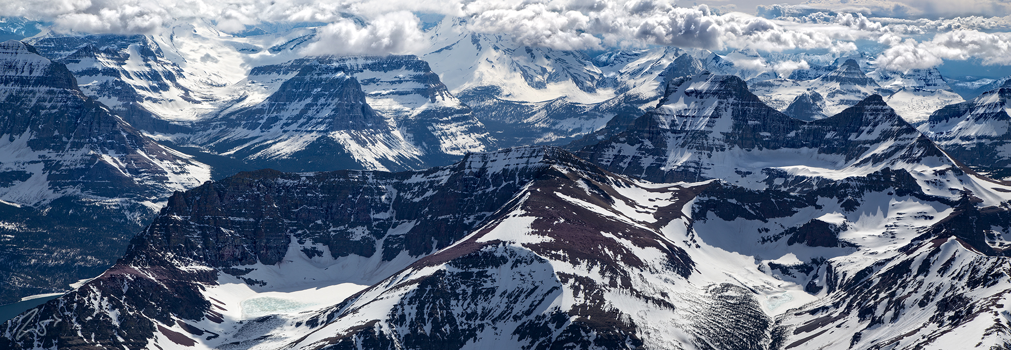
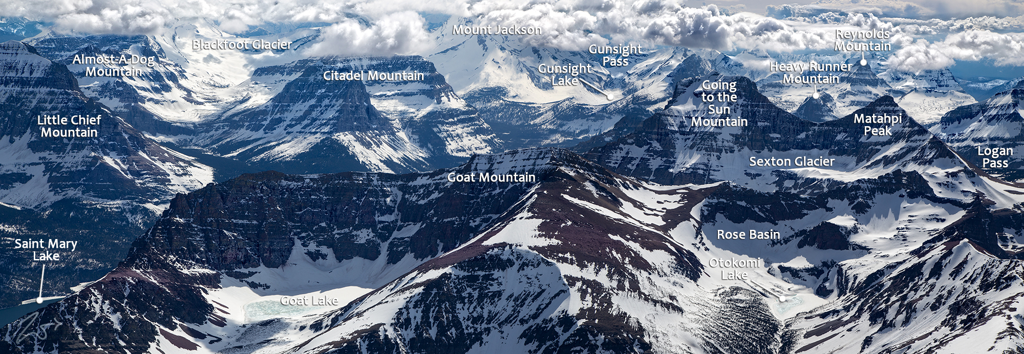
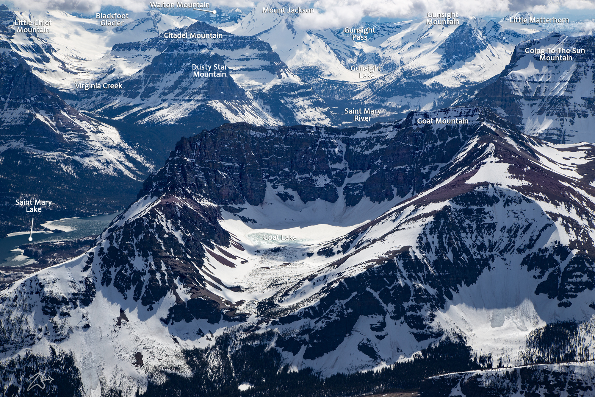
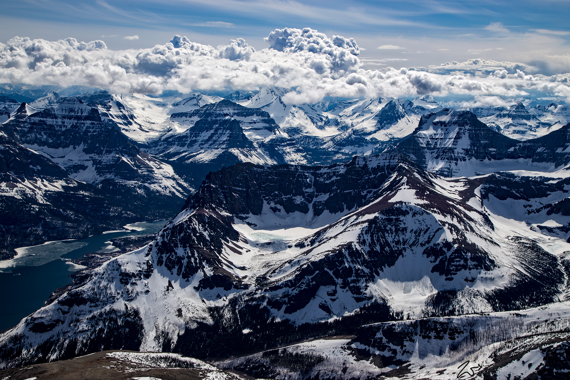
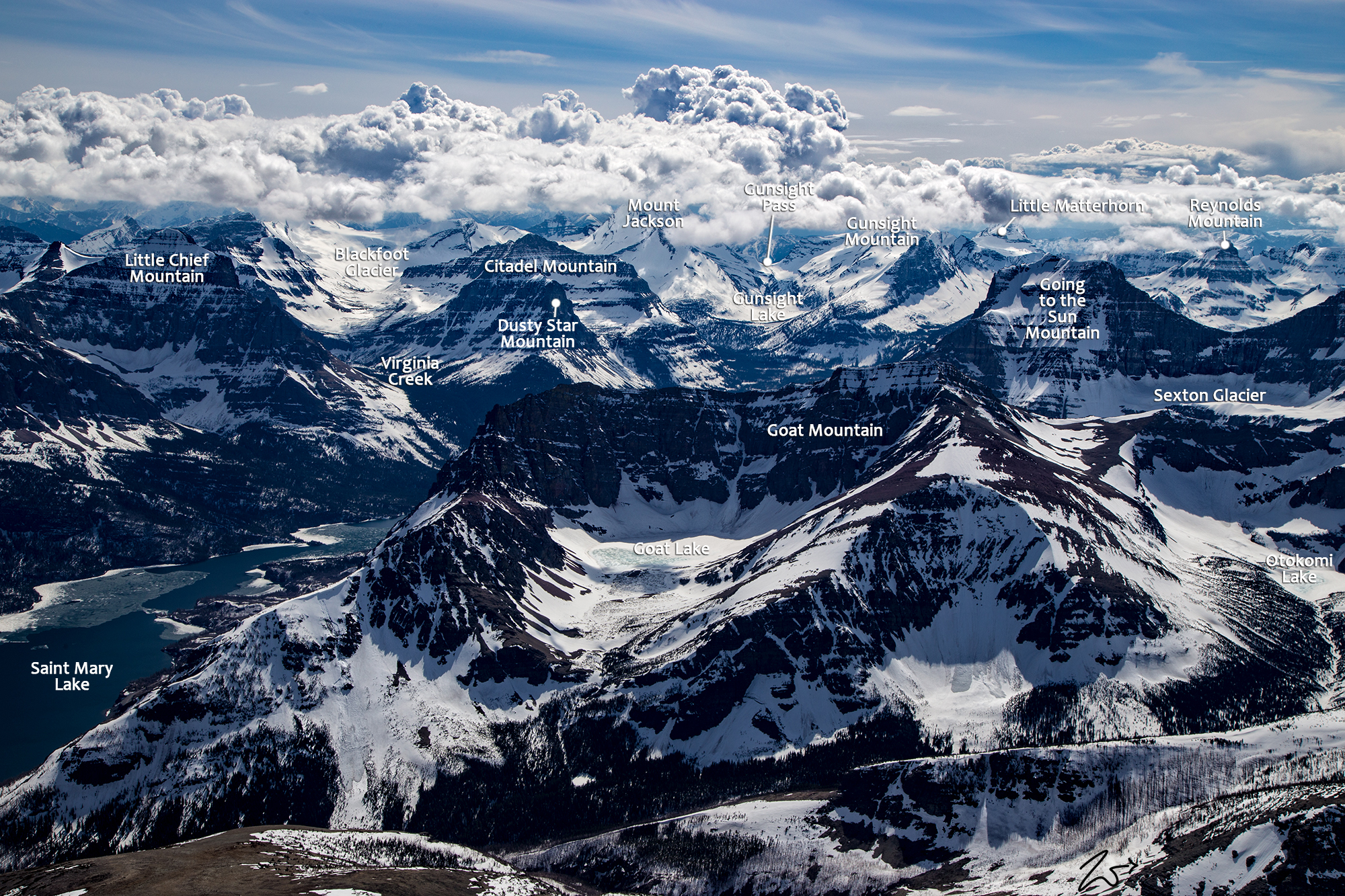
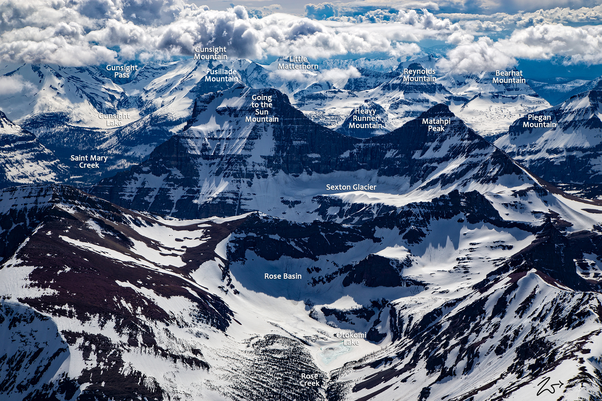
This image above is a straight-line panoramic vista of Goat Mountain and Going to the Sun Mountain in Glacier National Park. In the left foreground is Goat Mountain with its curved cliffs encircling a frozen Goat Lake in the glacial cirque below. In the lower right foreground, the still-frozen Otokomi Lake lies in the Rose Basin glacial cirque with the northern slopes of Goat Mountain on the left. Above and behind Rose Basin rises the iconic Going to the Sun Mountain, the large rectangular formation connected via a sloping ridgeline to the triangular-shaped peak to the right known as Matahpi Peak. Laying below that ridge is a large glacial cirque containing Sexton Glacier.
Laying in the distant valley on the left of this image is Saint Mary Lake, and across the distance the mountains in the background, beginning on the left above the lake are; Little Chief Mountain, Almost a Dog Mountain (un in the clouds), Dusty Star Mountain, Citadel Mountain and in the middle of the image, up in the mountains is Gunsight Lake. Gunsight Mountain is obscured by clouds but to the right is the towering ridge of Fusilade and peeking up behind Going to the Sun Mountain is Heavey Runner Mountain while in the far distance is Clements Mountain.
On the top right you can see through into the North Fork Valley. To view a large version of this image using your scroll bars to navigate around the image go here. The following images are closer looks at Goat Mountain and Going to the Sun Mountain.
~Select arrow for location key~
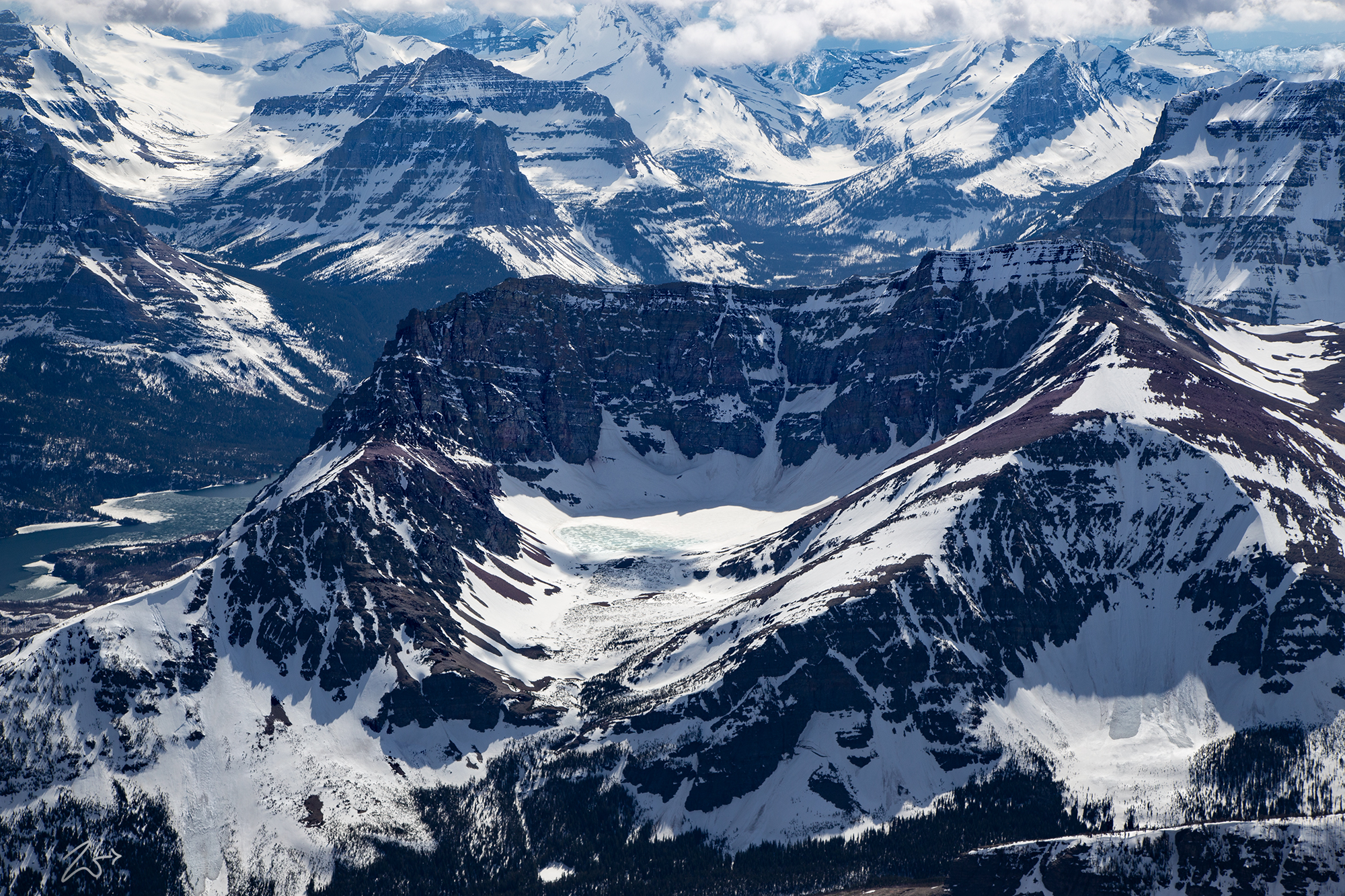
In this image above of Goat Mountain; In the middle is the unusual semi-bowl shape of the steep mountain ridge formation that rings the glacial cirque below, within which lays the tiny Goat Lake. This is a classic glacial cirque; an amphitheater-like valley formed over millions of years by a combination of glacial action and fluvial erosion. in various spots on the mountainside, there are debris trails left by large avalanches, notable on the left and right flanks of the mountain. While small looking in this image, each of the tiny black dots on the mountainside is actually a very large tree.
To the top right of the image is the ridgeline and peak of Going to the Sun Mountain. In the image below; Goat Mountain lays in the middle with Sant Mary Lake on the left side and Going to the Sun Mountain on the right, midway up the image. On the bottom right is Okotomi Lake. The ridge in the bottom foreground is part of Okotomi Mountain and this series of images was lensed while flying above Singleshot Mountain.
~Select arrow for location key~
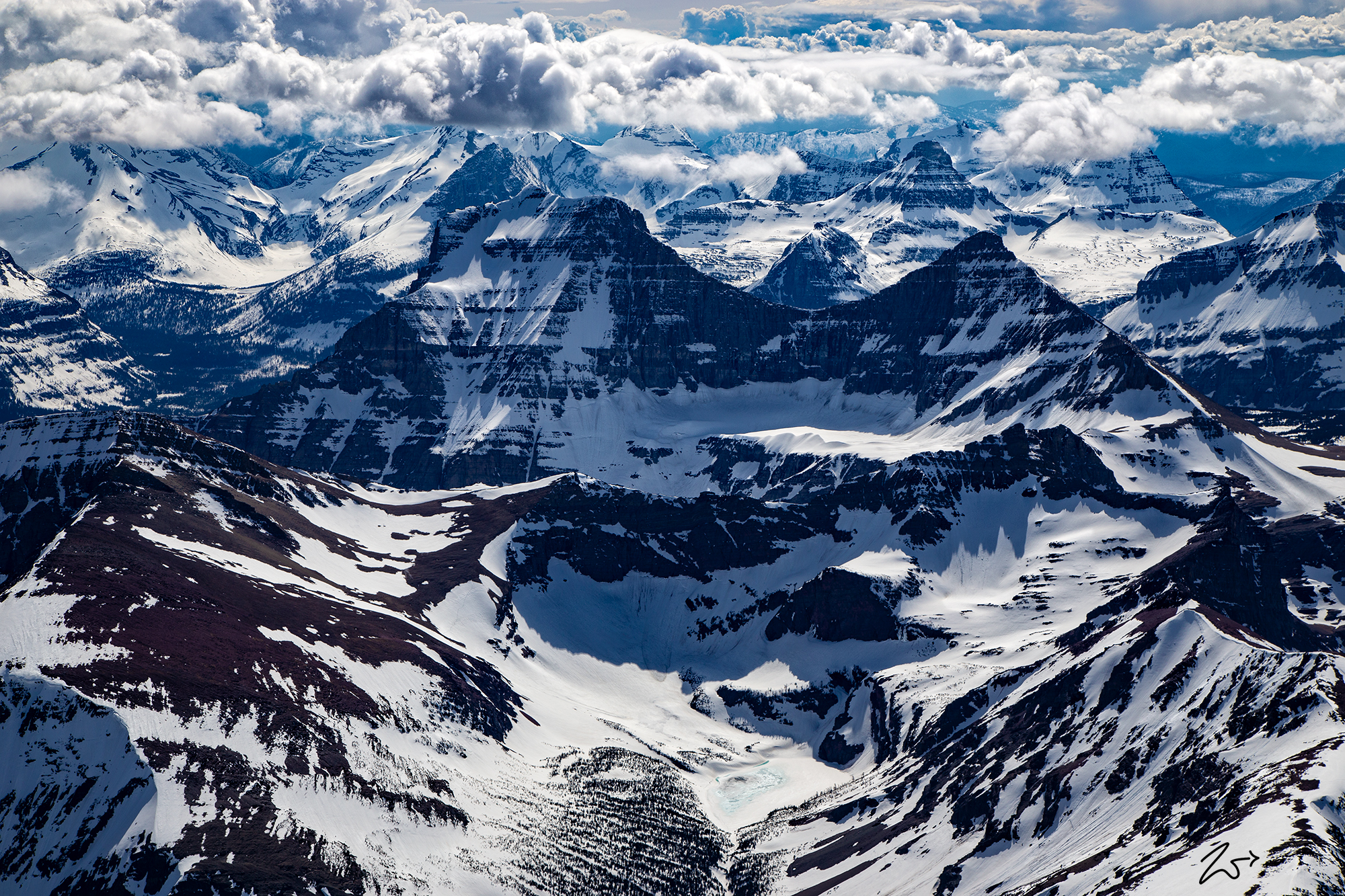
The following image focuses on Going To The Sun Mountain which is center left in this image, separated by the concave escarpment from the triangular shaped Matahpi Peak on the right. Clements Mountain sits directly above and to the slight left across the valley and Cannon Mountain is behind that, its peak covered with clouds.
~Select arrow for location key~
