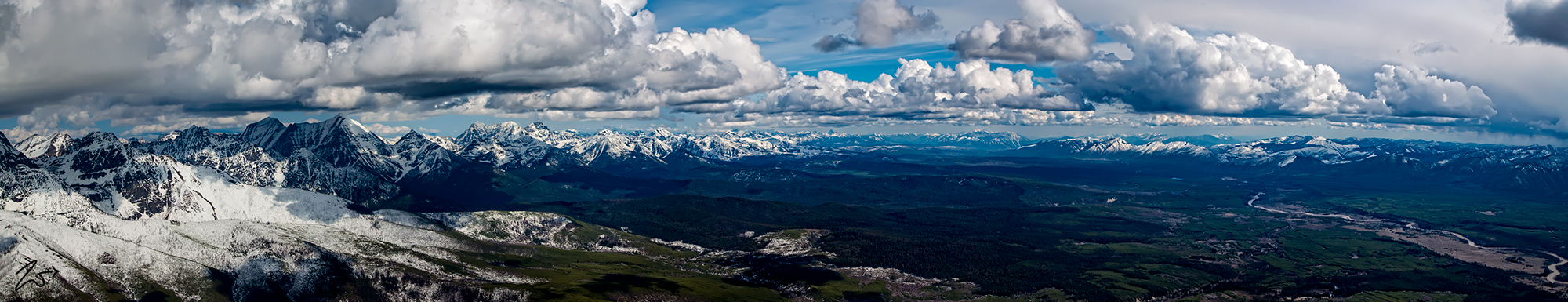
The North Fork of the Flathead River comes out of Canada, crossing the border into Montana near Kintla Lake. Winding its way south it crosses through a most beautiful valley sitting under the stunning, jagged skyline of the Lewis Range in Glacier National Park. This is a true wilderness, seen here in this panoramic vista, from above Starvation Ridge just west of the Boundary Mountains on the border of Canada and Montana.
This straight-line panorama encompasses the entire Livingston Range, The North Fork Valley, the Flathead National Forest, Coal Creek State Forest, The Apgar Range, and in the far distance, the Flathead Range and the Lewis Range. This is a unique vision of the unbridled beauty and wondrous glory of the wilderness of northern Montana.
To review the full-size panoramic photo please go here and use the scrollbars to navigate around the image. To view the location key for this image please select the arrow icon on the left side of the image.
