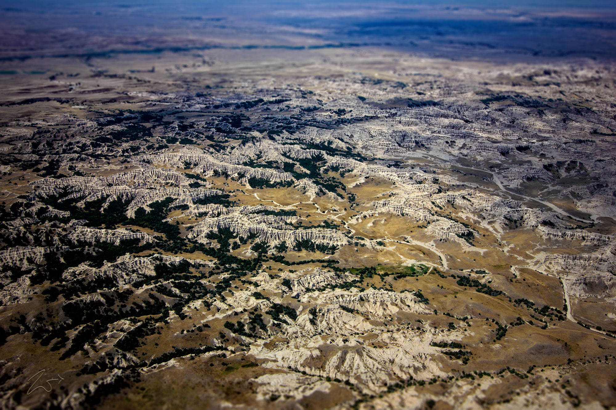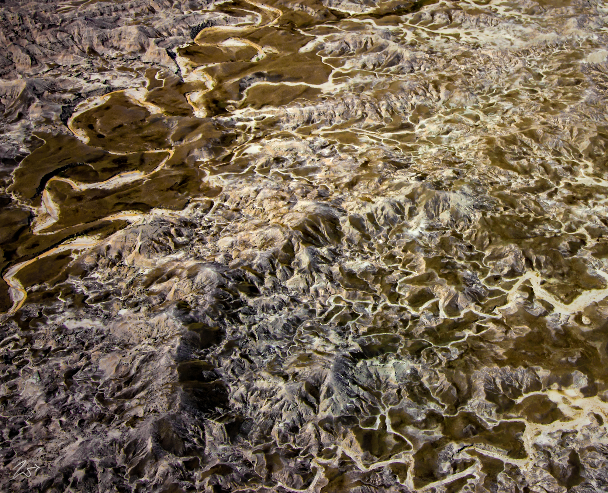
This intricate maze of rivulets and creeks cascading across the ground is an aerial close up of a small part of the Badlands National Park in South Dakota. The larger creek on the top left-hand side of this image is Little Squaw-Humper Creek. Badlands often have a spectacular color display that alternates from dark black/blue coal stria to bright clay to red scoria. This is a land of sharply eroded buttes, pinnacles, and spires blended with the largest area of undisturbed mixed-grass prairie in the United States.
The First Nations Lakota people were the first to call this place “mako sica” or “land bad.” Extreme temperatures, lack of water, and the exposed rugged terrain led to this name. French-Canadian fur trappers also called it “les mauvais terres pour traverse,” or “bad lands to travel through.”
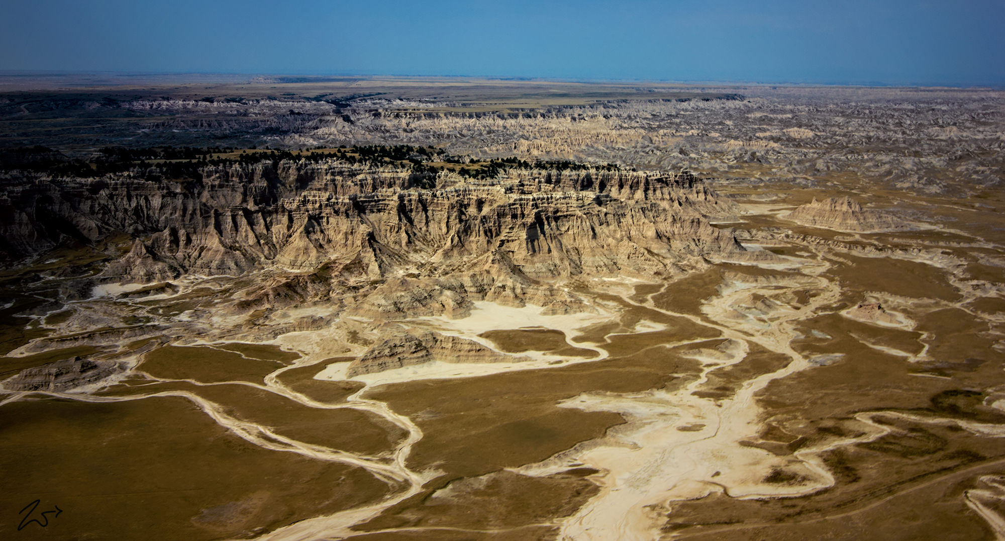
The term “badlands” is designated as a type of dry terrain where softer sedimentary rocks and clay-rich soils have been extensively eroded by wind and water. These are usually characterized by steep slopes, minimal vegetation, lack of a substantial regolith, and high drainage density. Canyons, ravines, gullies, buttes, mesas, hoodoos, and other such geological forms are common in badlands. They are often difficult to navigate on foot.