The First Nations Blackfoot, Flathead, Salish, Kootenai, and other tribes local to this area held these mountains in sacred reverence. Well beyond the relatively short span of recorded history, First Nations people began migrating south from the Alaska area. Traveling into what eventually became Montana, they established a rugged passageway along the length of the eastern flank of this imposing natural wall, the Rocky Mountains.
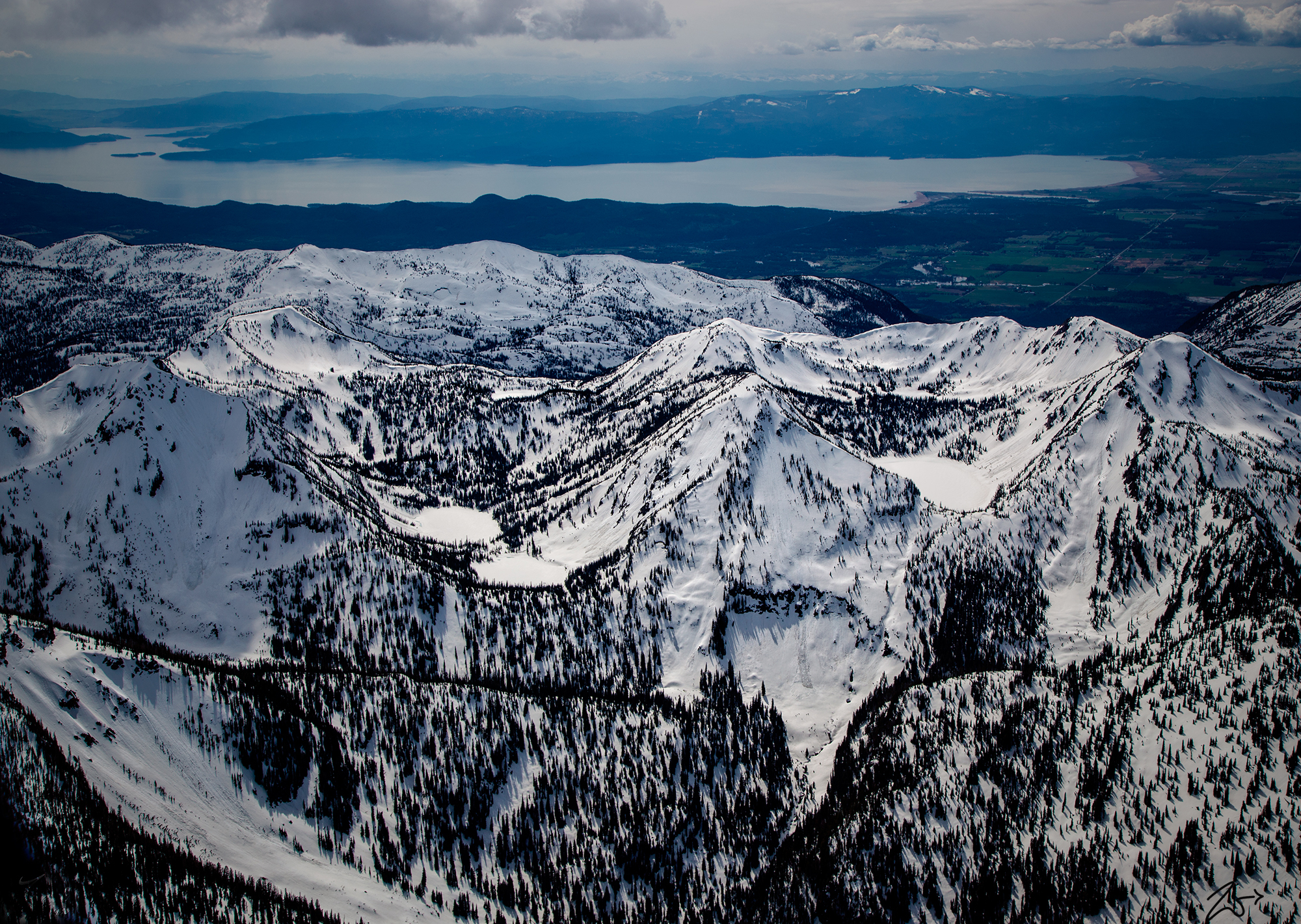
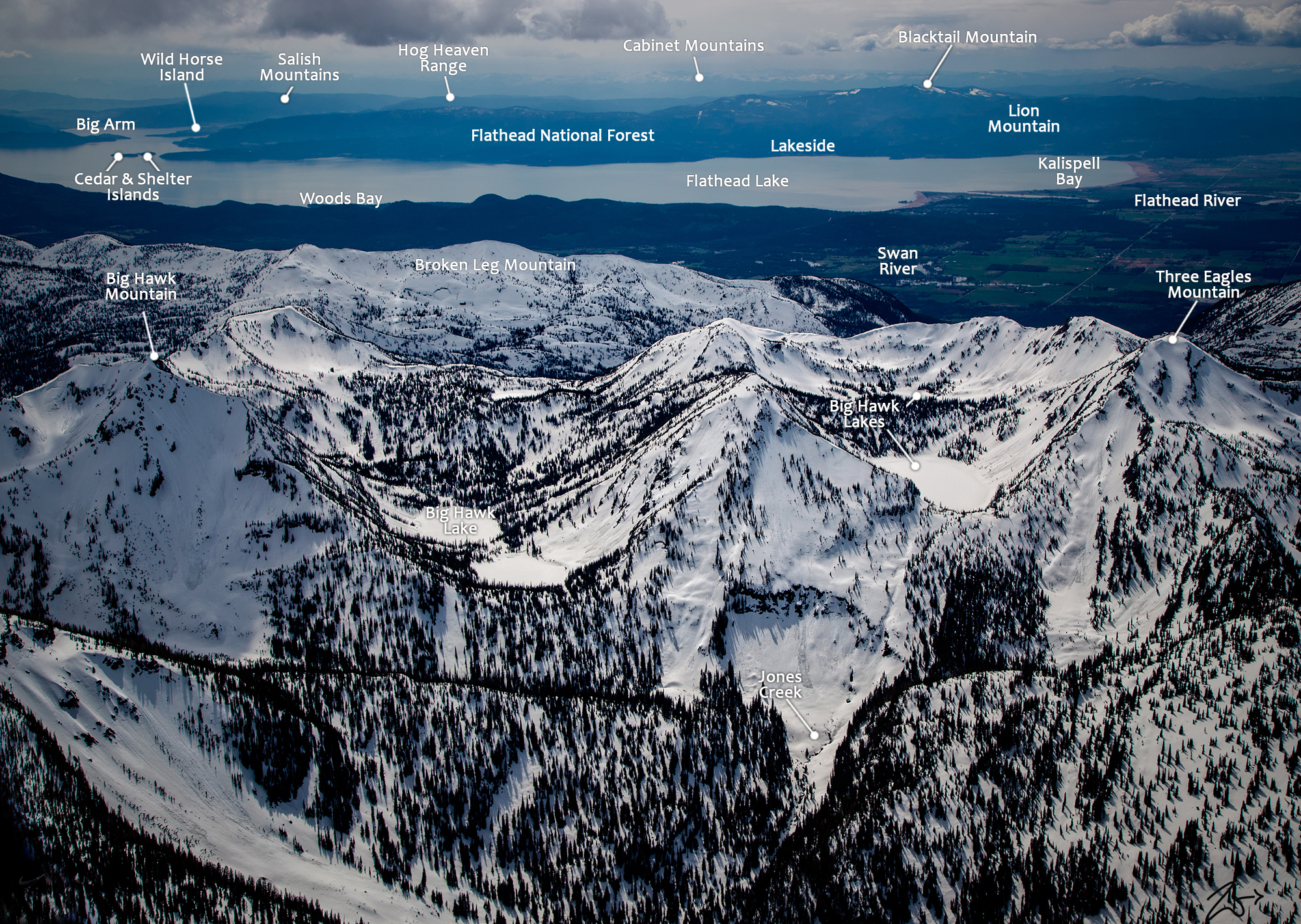
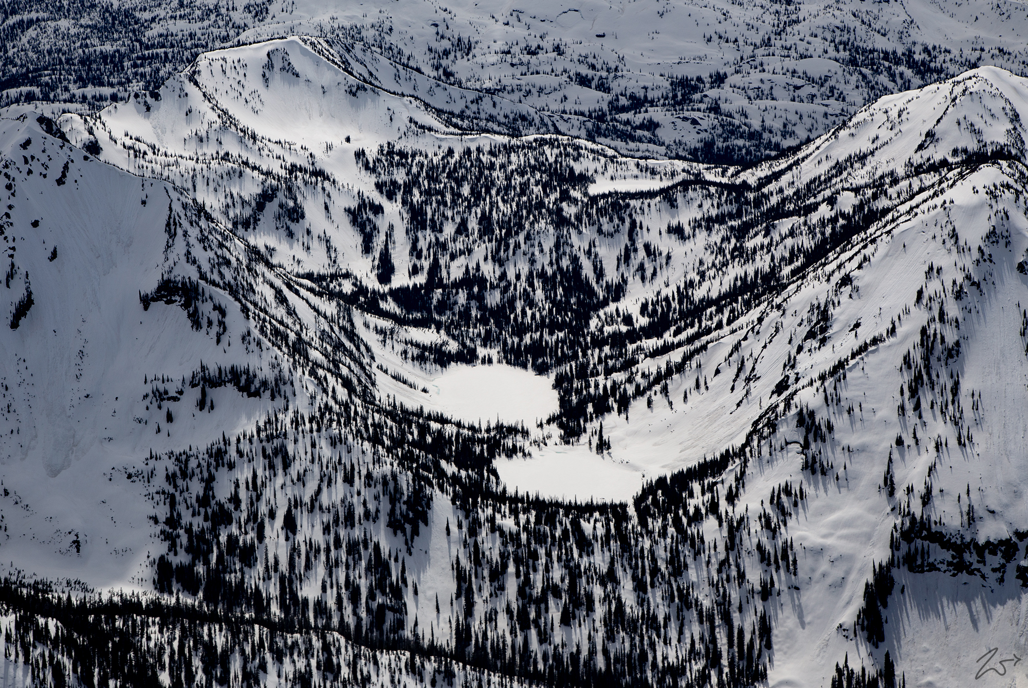
Along the ridgeline of Broken Leg Mountain in the image below, Big Hawk Mountain on the left sits above the frozen Big Hawk Lake and Pilgrim Lake sits below Three Eagles Mountain on the right. In the background up top lays the northern part of Flathead Lake. The snowcapped mountains across the distance are Blacktail Mountain and the Salish Mountains are to the left.
~Select arrow for location key~
This area is known as Jewel Basin, a beautiful part of the Flathead National Forest located on the Swan Range. In a small mountain top basin area of 15,349 acres (62.1 km²), there are 27 small glacial lakes. In the image below The twin frozen waters collectively called Big Hawk Lake are two ponds connected by a small creek. To the left is Big Hawk Mountain.
Historically known as the Old North Trail, finer details of the original path have been forgotten, lost in the early morning wet mist of surmise, however, ample evidence of its long-term human use is well-etched in the lands below. It was summer, 1805, while heading against Missouri River currents toward the Rocky Mountains that Meriwether Lewis first spied what he called in his journal, the “Shining Mountains” to the west. He wrote that the “sun glancing off of the snow gave the mountains a glittering appearance.” Today this 110-mile stretch is known as the Rocky Mountain Front and is considered one of the most iconic and dramatic places on the planet.
The arrival of the occupants of this area dates as early as 500 A.D. and most likely even centuries before that time. This area was located near a thoroughfare that was used by numerous nations as they relocated looking for a place to call home. The mountains held a sacred place for them, and surely each nation had their own names for the peaks and places in present-day Glacier National Park.
The Crown Of The Continent
This image above is a curved semi-panoramic image covering the Swan Range on the far left, the Flathead Range in the left-middle, and the Lewis Range with Glacier National Park on the right side. The Valley in the middle of the image is the Theodore Roosevelt Pass in the John F. Stevens Canyon containing the Middle Fork of the Flathead River. Click on the image to view this full-size panoramic photo with names listed for all these mountains, and the scroll bars to navigate around the image.
The Crown of the Continent encompasses more than 10-million acres of pristine, intact wildland. What is remarkable is that the plants and animals that Lewis and Clark found during their expedition still live in this beautiful wild ecosystem. It is a quintessential habitat for wildlife across Glacier National Park, the Bob Marshall Wilderness, and the Salmon-Selway Wilderness.
Flathead River South Fork
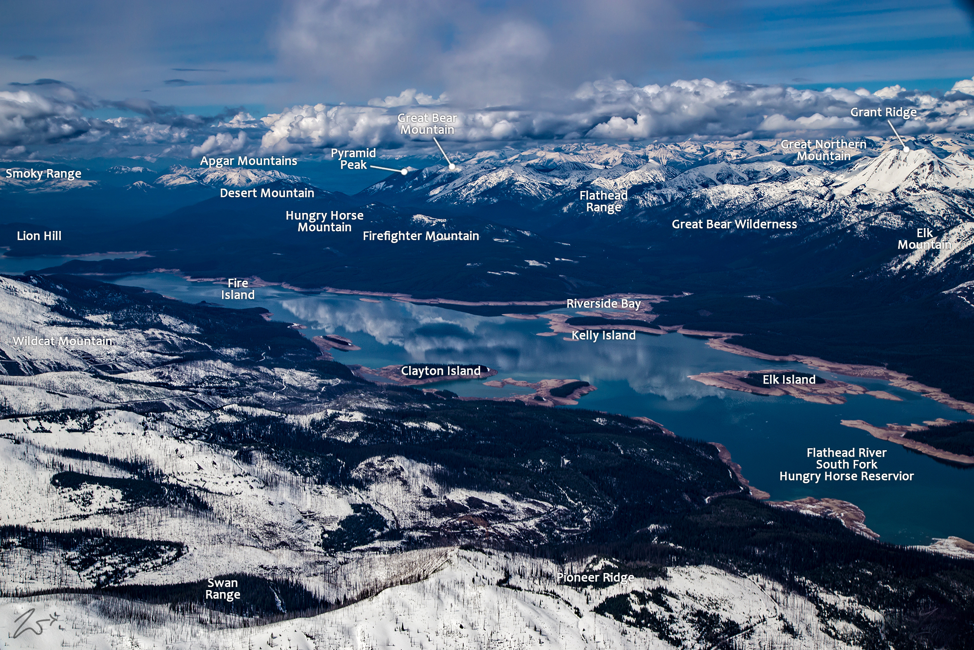
~Select arrow for location key~
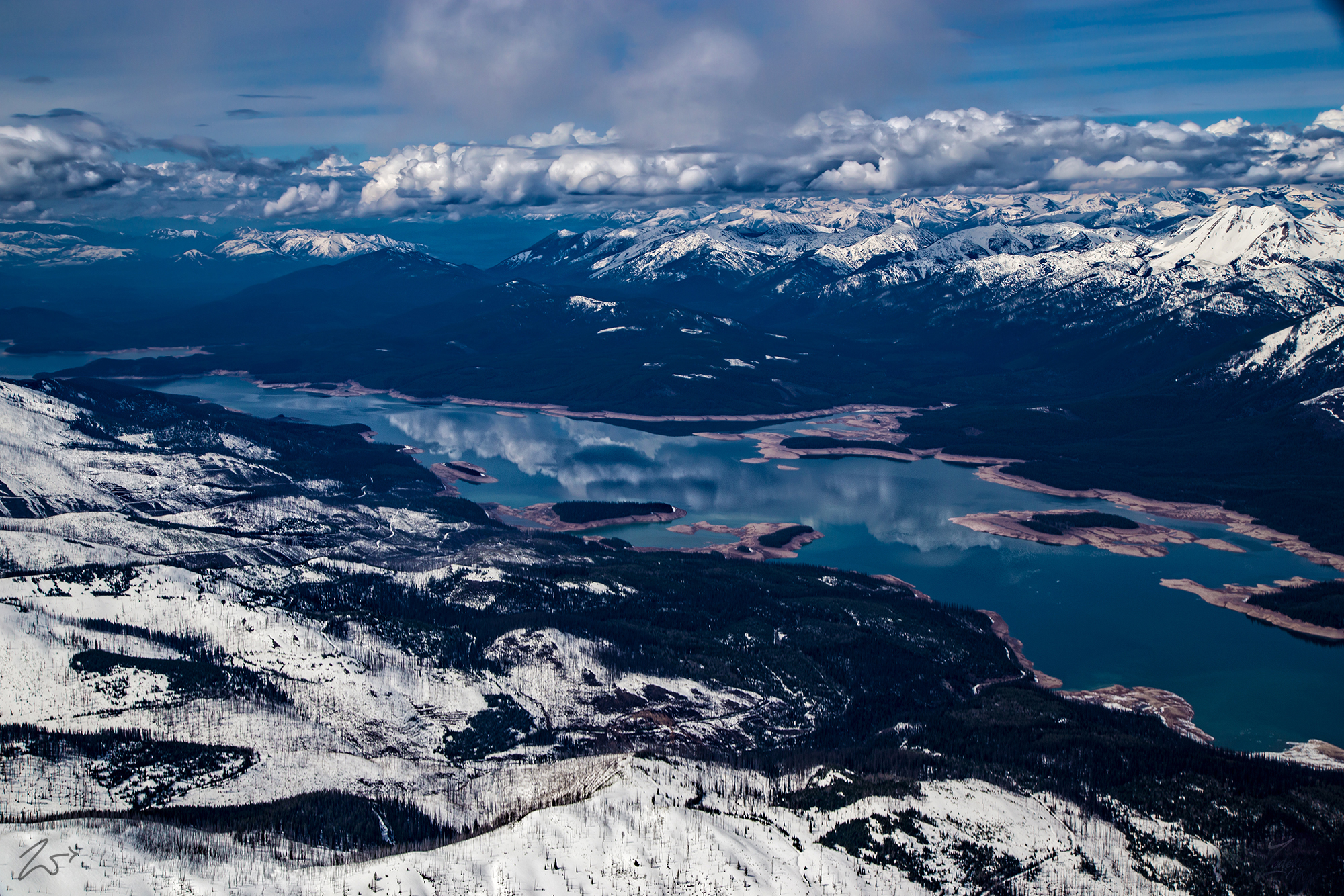
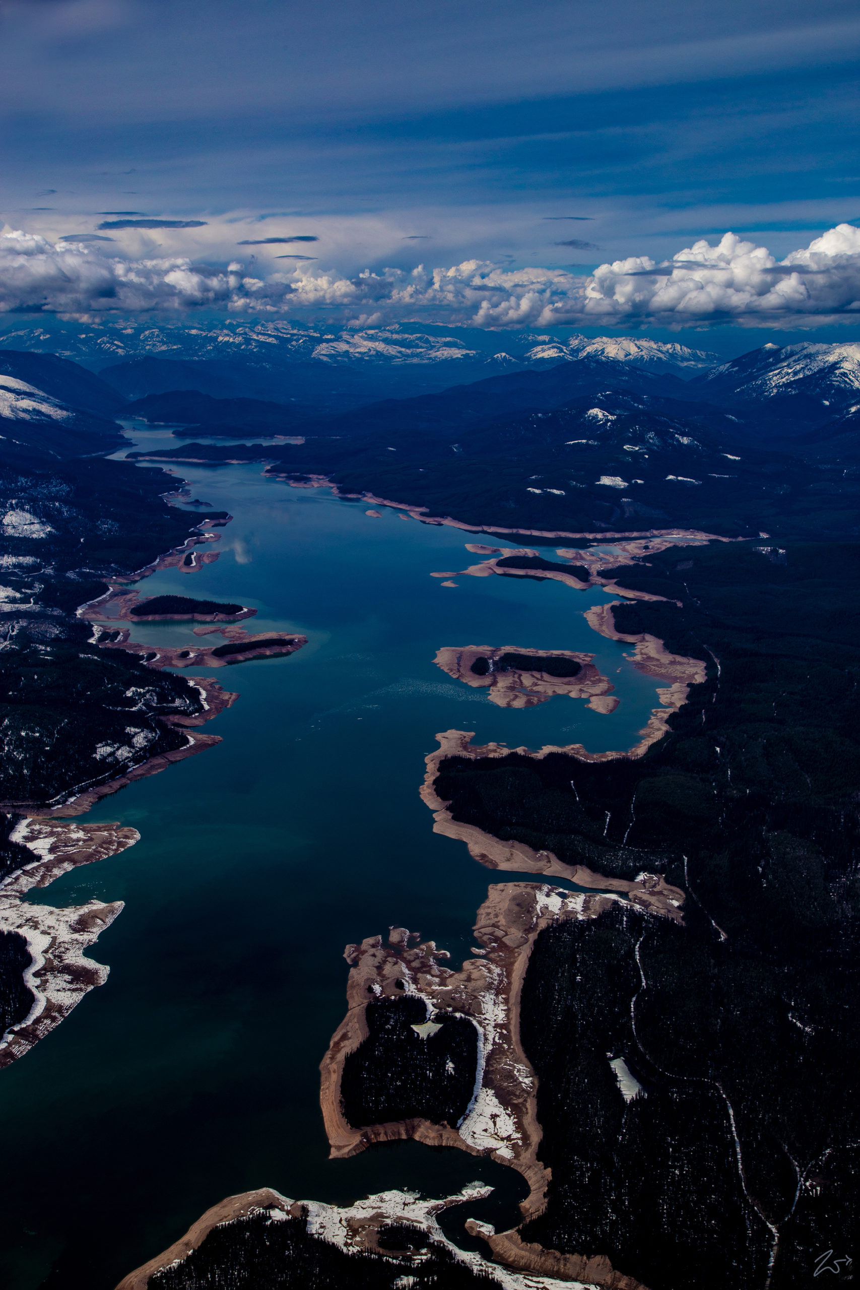
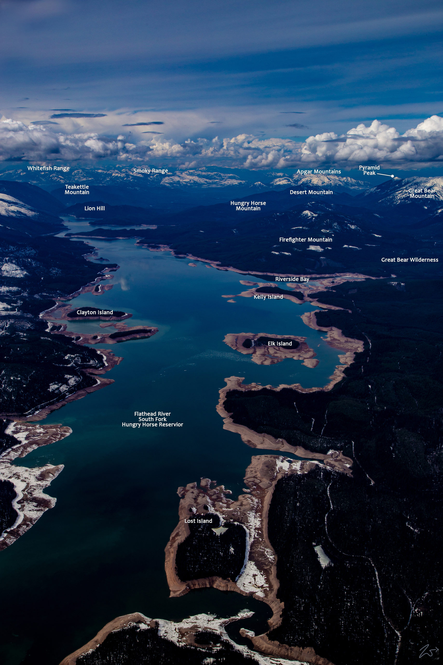
The South Fork of the Flathead River feeds into the Hungry Horse Reservoir in this image above looking north towards the Apgar Mountains alongside the Whitefish and Smokey Mountain Ranges in the distance. Photographed during the spring after the spring snowmelt has begun, the water levels have purposely been dropped to allow for the influx of melt runoff which will fill the 1,640 square mile catchment area to capacity. On the left side of the image is Pioneer Ridge and the Swan Mountain Range and the Flathead Range is on the right side.
In this scene viewed from above Pioneer Ridge on the eastern slopes of the Swan Range, The South Fork of the Flathead River becomes the Hungry Horse Reservoir. During May, the water has been lowered to allow for the deluge of snowmelt water soon to course down the many creeks, streams, and tributaries, rapidly filling the reservoir. In the distance across the river lays the Flathead Range, on the far right is Elk Mountain, and moving left are Mount Murray, Mount Grant, The Great Northern Mountain, and at the far end of the river, that mountain without any snow on it is Firefighter Mountain.
~Select arrow for location key~
In the image above starting at the bottom right, Lost Island is not much of an island with a land bridge exposed by the lowered water level. Higher up in the image lay Elk Island on the right, Clayton Island on the left, and Kelly Island on the top right. This large reservoir occupies much of the lower half of the river, covering 97 square miles (250 km2).
The reservoir trends north then northwest ( to the left in the image), and passes through the arched Hungry Horse Dam (at the very top end of the lake). The river then enters a deep narrow gorge and exits the canyon for the final time as it runs northwest past the town of Hungry Horse before merging with the Middle Fork of the Flathead River. From there it turns southward around the Swan Range and joins with the North Fork of the Flathead River before flowing serpentine-like through a series of oxbow bends and turns, finally emptying into Flathead Lake.

