~Select arrow for location key~
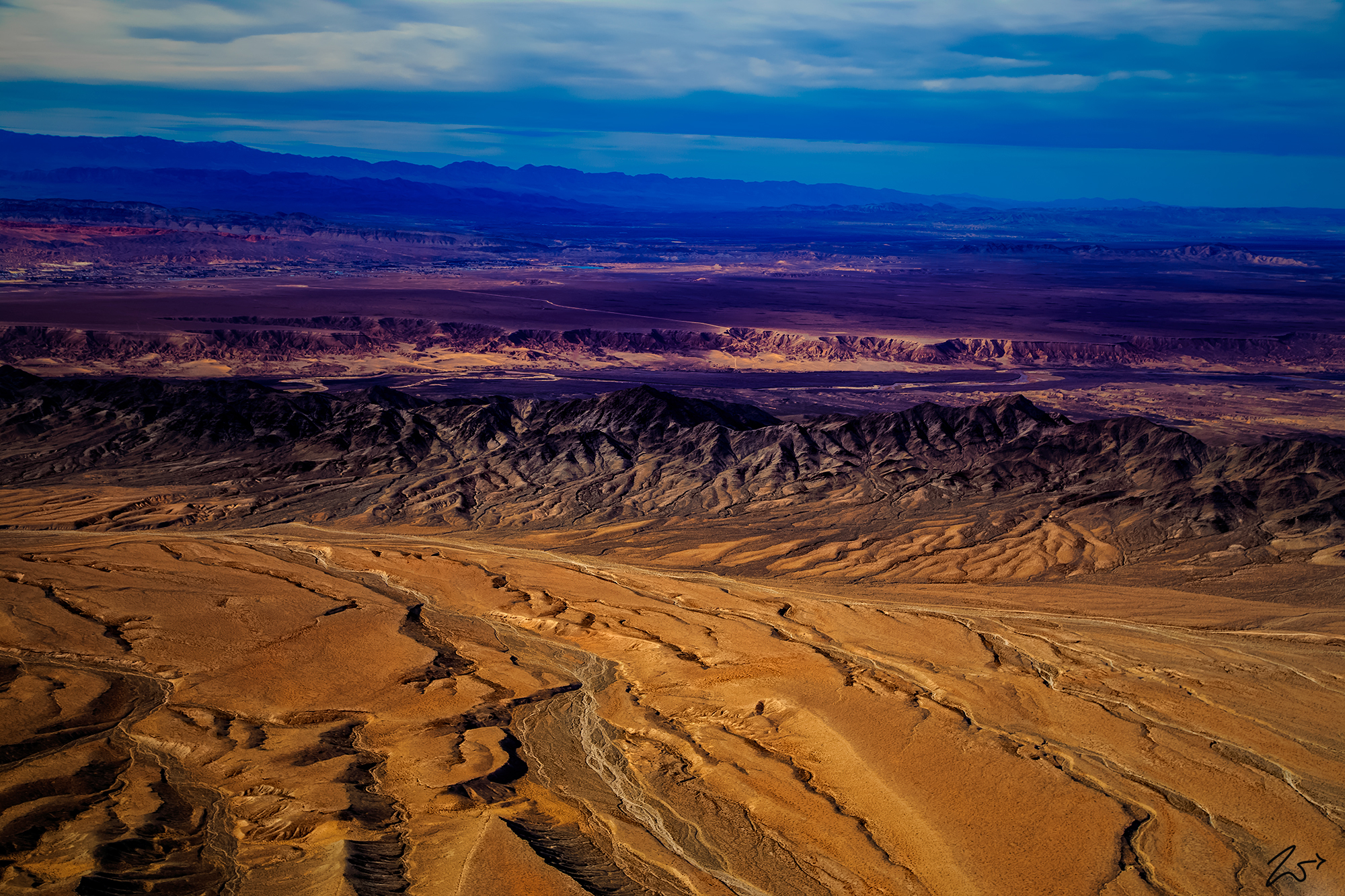
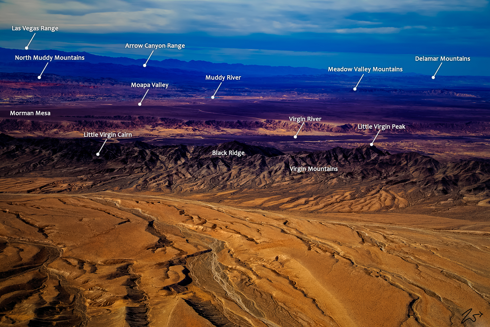
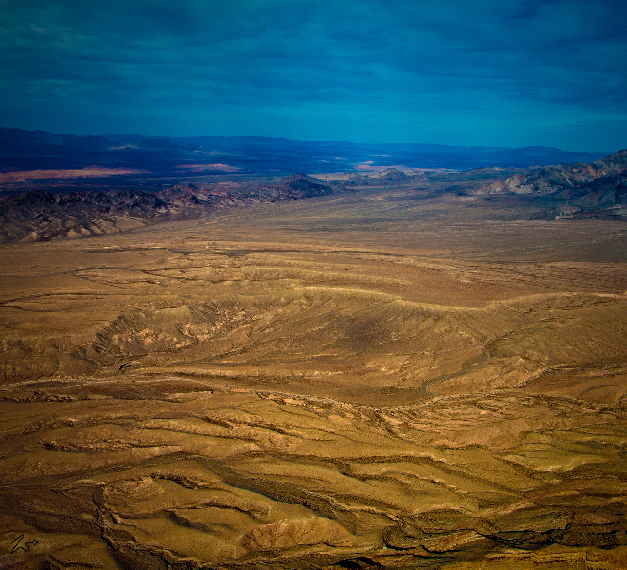
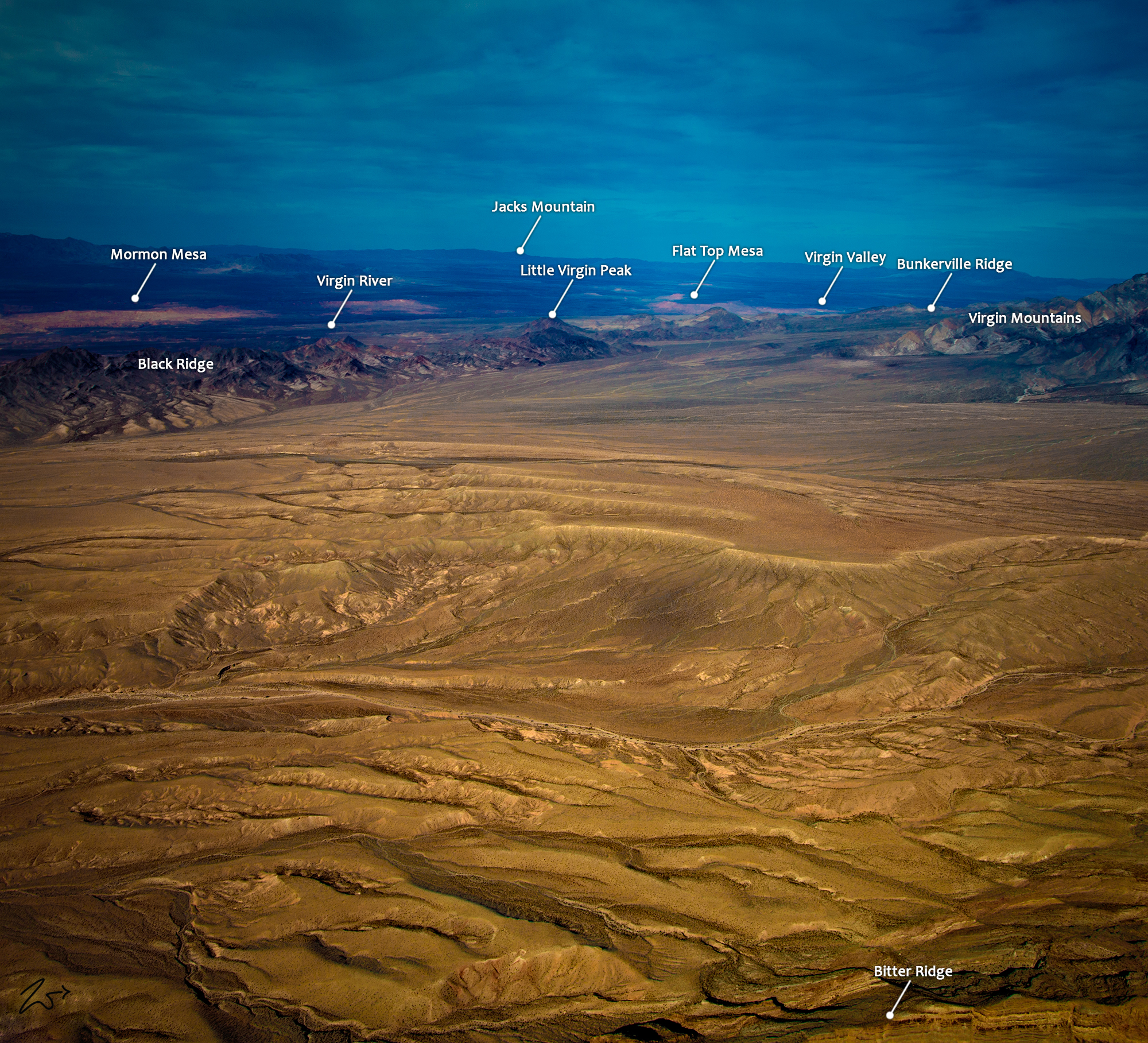
These brilliant red and burnt orange colors come from the early morning sunlight interacting with the red sands that are blown by the wind across the Virgin River Basin just east of Lake Mead, Nevada. In the foreground are the many rivulets that run into Lake Mead where it meets the Virgin River at Long Bottom. The dark ridge line running horizontally across the image is called Black Ridge, a small range in the Virgin Mountains. Right on the other side of Black Ridge, you can see the Virgin River and Mormon Mesa.<
Zedekiah: “I lensed these images while flying directly above Bitter Ridge and Red Bluff Spring. It was an overcast spring morning and you can see the bright spots across the valley as the sun is peeking through. This was taken with a Hasselblad H5D 60mpx camera which has a really nice medium format sensor with wonderfully deep pixel well depth and a very rich Bayer layer. This provides rich, lush, and vibrant colors across the spectrum along with incredible landscape detail. I love how you can clearly see the pattern of red sand blown in from the Valley of Fire to the south and deposited across the south side of Black Ridge.”
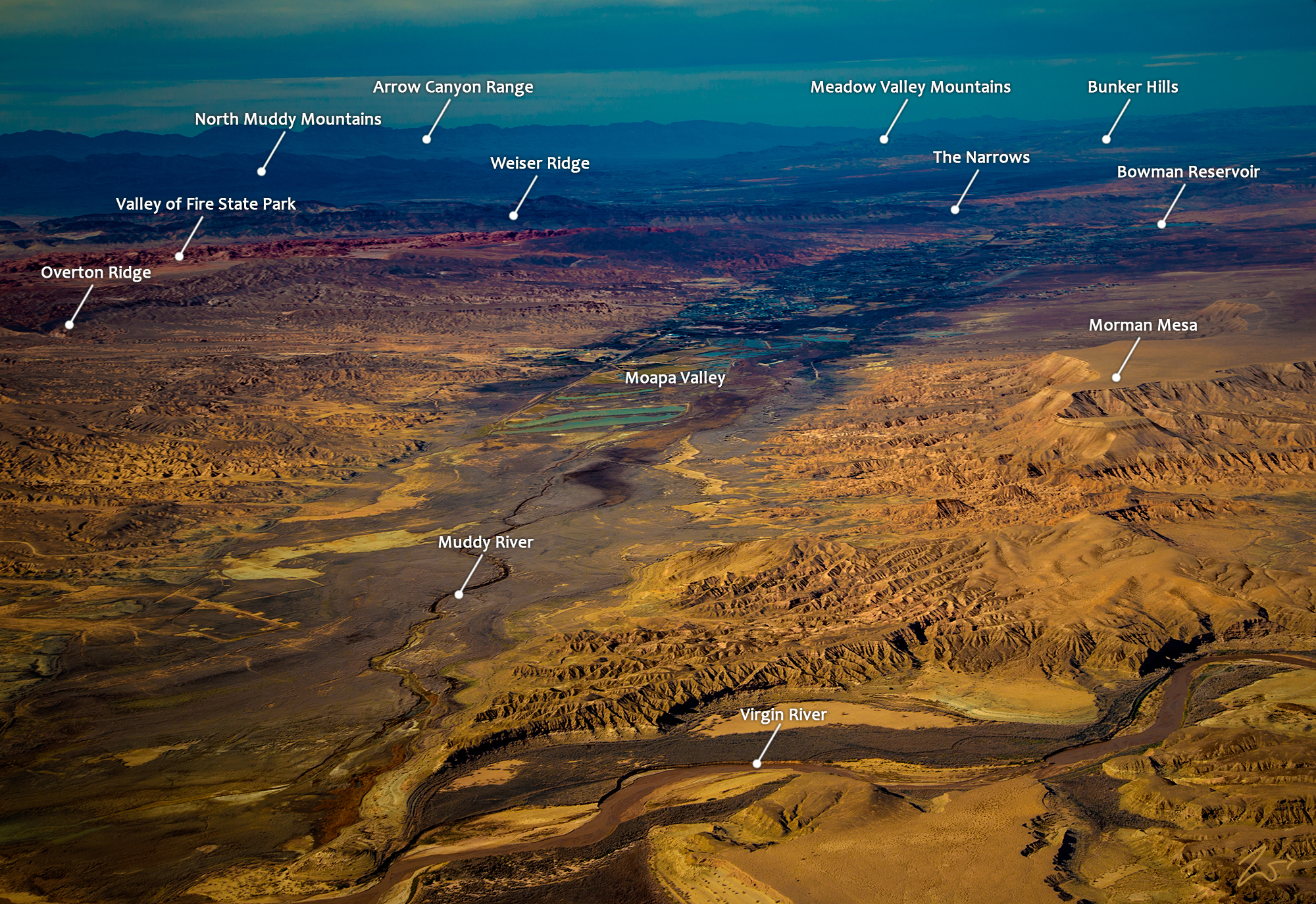
On the top of Mormon Mesa below the mountains in the distance, you can see the tiny community of Logandale along the Muddy River in the Moapa Valley. Beyond Logandale are the North Muddy Mountains then the First Nations Moapa Reservation and beyond that those large mountains are called the Arrow Canyon Range.
This area is the ancestral homeland of the First Nations Moapa Band of Paiutes. Originally known as the Moapat and the Nuwuvi, these ancient peoples developed irrigation agriculture long before contact with European settlers, and once they did make contact with settlers, they suffered greatly from early Spanish slave raider attacks in the 18th and 19th centuries. They still occupy the reservation lands along the Moapa River though their numbers were decimated greatly by disease back in the 1920s.
~Select arrow for location key~
In the image above, the aptly named Muddy River flows down from the Muddy Mountains Wilderness through the Moapa Valley and south into Lake Mead. First Nations Tribes have occupied these mountains for thousands of years. They have left behind rock art, artifacts, agave roasting pits, and rock shelters.
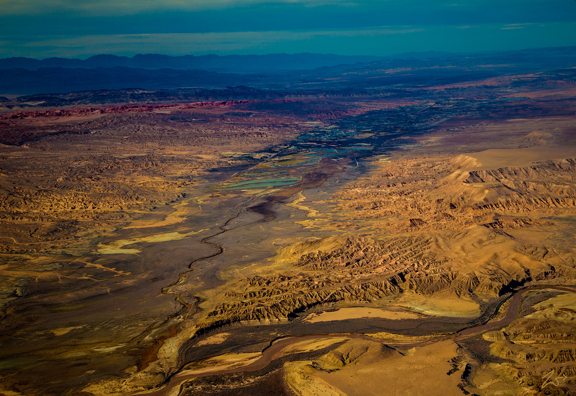
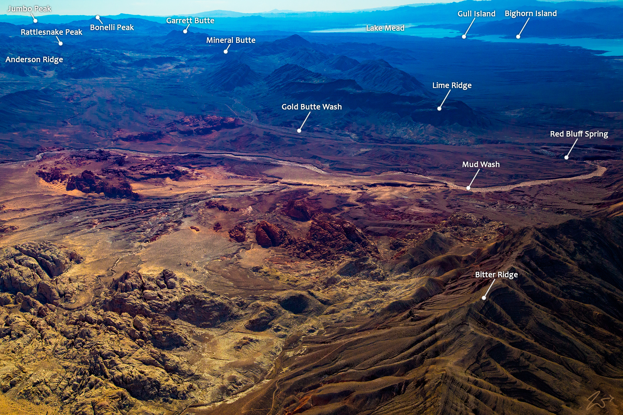
Zedekiah: Looking behind me I lensed this image below while over Red Rock Springs (in the bottom left foreground), while Lake Mead is in the top right of the image. This is an unusually harsh environment yet ancestral First Nations Anasazi People are thought to have migrated into the region about 300 B.C. and while here, survived on a mostly vegetarian diet consisting of all kinds of cactus and plants including yucca, mesquite tree, prickly pear, and beavertail.
~Select arrow for location key~
Looking back to the north in the image below, this is part of the Virgin Mountains National Natural Area, part of the Gold Butte National Monument. The line of small hills on the left side of the image is called Black Ridge and where it joins the larger Virgin Mountains on the right side, that small peak in the middle of the two ranges is called Little Virgin Peak.
~Select arrow for location key~
On the other side of the valley in the images above and below is the First Nations Moapa Indian Reservation. These are the descendants of the original people who occupied these lands for so long including the Ancient Pueblo Peoples, also known as the Anasazi, who were farmers from the nearby fertile Moapa Valley.
Eventually, they learned to plant corn and beans and hunt animals like rabbits, sheep, and antelope. Their approximate span of occupation has been dated from 300 BC to 1150 AD. Their visits probably involved hunting, food gathering, and religious ceremonies, although the scarcity of water would have limited their stay. Fine examples of rock art (petroglyphs) left by these ancient peoples can be found at several sites within the valley.
